IMAGES TAKEN NEAR TO
Portsmouth Road, KINGSTON UPON THAMES, KT1 2NY

Introduction

This page details the photographs taken nearby to Portsmouth Road, KT1 2NY by members of the Geograph project.

The Geograph project started in 2005 with the aim of publishing, organising and preserving representative images for every square kilometre of Great Britain, Ireland and the Isle of Man.

There are currently over 7.5m images from over14,400 individuals and you can help contribute to the project by visiting https://www.geograph.org.uk

Image Map


Images are licensed for reuse under creativecommons.org/licenses/by-sa/2.0
Notes
  • Clicking on the map will re-center to the selected point.
  • The higher the marker number, the further away the image location is from the centre of the postcode.

Image Listing (119 Images Found)

Images are licensed for reuse under creativecommons.org/licenses/by-sa/2.0
  • ...
Image
Details
Distance
1
View across the Thames from the Thames Path/Barge Walk
The church is St Raphael's Roman Catholic Church http://www.straphael.org.uk/our_church.htm which is designated Roman Catholic Church to nearby Kingston University
Image: © Eirian Evans Taken: 13 Oct 2011
0.03 miles
2
Palace Mansions, Palace Road
Image: © Hugh Venables Taken: 13 Apr 2017
0.04 miles
3
Home Park Court
This is the northern end of a long apartment block on the Portsmouth Rd. This section faces onto Palace Rd in the foreground. The right hand of the image faces out towards the Thames.
Image: © Nigel Mykura Taken: 21 Jul 2013
0.04 miles
4
Queen's Promenade
With a couple of sections redone recently.
Image: © Hugh Venables Taken: 13 Apr 2017
0.04 miles
5
Queen's Promenade
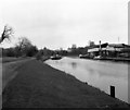
Narrowboat, "Jeremy Fisher II" moored beside the Thames near Kingston. The promenade is a popular walkway.
Image: © Colin Smith Taken: 15 Aug 2010
0.04 miles
6
Anglesea Road, Kingston upon Thames
Image: © Stacey Harris Taken: 6 Nov 2010
0.05 miles
7
Palace Garage, Surbiton
Image: © Hugh Venables Taken: 13 Apr 2017
0.05 miles
8
The River Thames from Queen's Promenade
Queen’s Promenade was opened by Queen Victoria in 1856 when she drove along the rebuilt Town’s End Road on her way back from a visit to Claremont at Esher. One thousand schoolchildren lined the road, which had been renamed Queen’s Parade. It is now known as Portsmouth Road. Before the 1850s the river banks had been worked for gravel, and the old road was undermined. William Woods, a local builder, undertook to provide a promenade from Raven’s Ait to St Raphael’s Church, if the Corporation would complete it up to the High Street. The section of Queen's Promenade seen here was within the William Woods' part. Kingston Bridge can be seen in the distance.
Image: © Marathon Taken: 5 Jun 2013
0.05 miles
9
Surbiton - Rowing Club
Typical rowing clubhouse on the bank of the River Thames upstream of Kingston Bridge.
Image: © Colin Smith Taken: 8 Aug 2017
0.05 miles
10
River Thames near Raven's Ait
Raven's Ait, whose north end is visible in the picture, can be navigated on either side. Usual practice is, of course, to keep to the right whether going up or downstream.
Image: © Dr Neil Clifton Taken: 28 Feb 1982
0.06 miles
  • ...