IMAGES TAKEN NEAR TO
Penrhyn Road, KINGSTON UPON THAMES, KT1 2DW
Introduction
This page details the photographs taken nearby to Penrhyn Road, KT1 2DW by members of the Geograph project.
The Geograph project started in 2005 with the aim of publishing, organising and preserving representative images for every square kilometre of Great Britain, Ireland and the Isle of Man.

There are currently over 7.5m images from over14,400 individuals and you can help contribute to the project by visiting https://www.geograph.org.uk
Image Map (Loading...)


Getting Data...Please wait
Leaflet Map data © OpenStreetMap
Images are licensed for reuse under creativecommons.org/licenses/by-sa/2.0
Notes
- Clicking on the map will re-center to the selected point.
- The higher the marker number, the further away the image location is from the centre of the postcode.
Image Listing (163 Images Found)
Images are licensed for reuse under creativecommons.org/licenses/by-sa/2.0
Image
Details
Distance
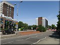
1
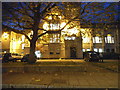
County Hall, Kingston
Besides not officially being in the county of Surrey since 1965 (except postally as it cost too much to change the codes) the main administrative centre remains in Kingston.
Image: © David Howard
Taken: 17 Nov 2014
0.01 miles
3
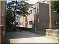
Oaklea Passage, Kingston upon Thames
A footpath off Penrhyn Road at the southern end of the town centre.
Image: © Richard Vince
Taken: 16 May 2014
0.10 miles
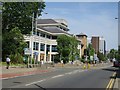
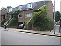
5
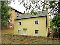
Cottage, Kingston
This charming little house is, like its neighbours along Oaklea Passage, overshadowed by town centre blocks, such as the multi-storey car park you can see in the background. It dates from about 1820. "The house retains both external and internal features remarkably complete" https://www.historicengland.org.uk/listing/the-list/list-entry/1253326 .
Image: © Derek Harper
Taken: 29 May 2016
0.11 miles
6
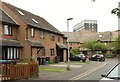
Watersplash Close, Kingston
A cul-de-sac passed by the London Loop and the Thames Down Link.
Image: © Derek Harper
Taken: 29 May 2016
0.11 miles
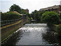
8
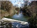
Hogsmill River
Looking upstream towards Knights Park Bridge. Very shallow angle weir.
Image: © Hugh Venables
Taken: 8 Apr 2006
0.12 miles
9
Flood-tolerant houses, Kingston upon Thames
These are in Denmark Road. They are quite different to the adjacent property with the living area clearly raised above anticipated flood level.
Image: © Julian Smith
Taken: 30 Jun 2006
0.12 miles
10
River Hogsmill Gauging Weir, Kingston upon Thames
Looking upstream from footbridge.
Image: © Julian Smith
Taken: 30 Jun 2006
0.12 miles