IMAGES TAKEN NEAR TO
Old Common Road, COBHAM, KT11 1JP
Introduction
This page details the photographs taken nearby to Old Common Road, KT11 1JP by members of the Geograph project.
The Geograph project started in 2005 with the aim of publishing, organising and preserving representative images for every square kilometre of Great Britain, Ireland and the Isle of Man.

There are currently over 7.5m images from over14,400 individuals and you can help contribute to the project by visiting https://www.geograph.org.uk
Image Map
Images are licensed for reuse under creativecommons.org/licenses/by-sa/2.0
Notes
- Clicking on the map will re-center to the selected point.
- The higher the marker number, the further away the image location is from the centre of the postcode.
Image Listing (13 Images Found)
Images are licensed for reuse under creativecommons.org/licenses/by-sa/2.0
Image
Details
Distance
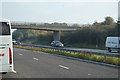
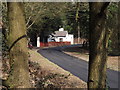
1
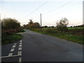
A3 towards London
Between the A245 and A244 junctions.
Image: © Robin Webster
Taken: 24 Aug 2012
0.13 miles
3
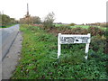
Sign to Chestnut Farm on Old Common Road
Old Common Road is gated, the end part becoming Norwoord Farm Lane which is the access to Norwood Farm, with no public access on road or on foot.
Image: © David Howard
Taken: 11 Nov 2012
0.18 miles
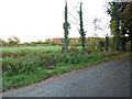
4
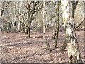
Old Common Nature Reserve
Patch of open birch woodland in a small nature reserve on the northern edge of Cobham.
http://en.wikipedia.org/wiki/Cobham,_Surrey
Image: © Colin Smith
Taken: 23 Mar 2012
0.18 miles
5
The entrance to Chestnut Farm off Old Common Road
Image: © David Howard
Taken: 11 Nov 2012
0.19 miles
6
Old Common
Birch woodland in this Nature Reserve wedged between Cobham and the A3.
http://en.wikipedia.org/wiki/Cobham,_Surrey
Image: © Colin Smith
Taken: 23 Mar 2012
0.19 miles
7
Old Common Road, Cobham
By the entrance to Chestnut Lodge Farm
Image: © David Howard
Taken: 11 Nov 2012
0.19 miles
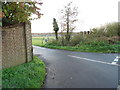
8
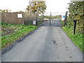
Do not pass!
This is the point where the public Old Common Road becomes Norwood Farm Lane, and also enters the next gridsquare I needed, TQ1062. But as you see, there is no way round the checkpoint and ordinary people will have to enter it from the north in Hersham, the other side of the River Mole.
Image: © David Howard
Taken: 11 Nov 2012
0.19 miles
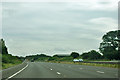
9
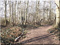
Old Common Road
Country lane leading north from Old Common at Cobham.
http://en.wikipedia.org/wiki/Cobham,_Surrey
Image: © Colin Smith
Taken: 23 Mar 2012
0.20 miles