IMAGES TAKEN NEAR TO
Seven Hills Road, COBHAM, KT11 1EU
Introduction
This page details the photographs taken nearby to Seven Hills Road, KT11 1EU by members of the Geograph project.
The Geograph project started in 2005 with the aim of publishing, organising and preserving representative images for every square kilometre of Great Britain, Ireland and the Isle of Man.

There are currently over 7.5m images from over14,400 individuals and you can help contribute to the project by visiting https://www.geograph.org.uk
Image Map
Images are licensed for reuse under creativecommons.org/licenses/by-sa/2.0
Notes
- Clicking on the map will re-center to the selected point.
- The higher the marker number, the further away the image location is from the centre of the postcode.
Image Listing (5 Images Found)
Images are licensed for reuse under creativecommons.org/licenses/by-sa/2.0
Image
Details
Distance
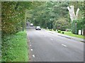
4
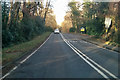
B365 Seven Hills Road
Heading north towards Walton-on-Thames.
Image: © Robin Webster
Taken: 25 Nov 2017
0.21 miles
5
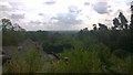
St George's Hill View
The Apex is 78m, a large Roman Fort was built here. The hill around the flat fort area is surprisingly steep.
This view looks over the mole valley to Cobham nearly 60m below.
A secret walk can be found that follows the fort walls in aptly named Camp End Road.
https://en.wikipedia.org/wiki/St._George%27s_Hill
Image: © James Emmans
Taken: 1 Aug 2014
0.25 miles