IMAGES TAKEN NEAR TO
Milbrook, ESHER, KT10 9EJ

Introduction

This page details the photographs taken nearby to Milbrook, KT10 9EJ by members of the Geograph project.

The Geograph project started in 2005 with the aim of publishing, organising and preserving representative images for every square kilometre of Great Britain, Ireland and the Isle of Man.

There are currently over 7.5m images from over14,400 individuals and you can help contribute to the project by visiting https://www.geograph.org.uk

Image Map


Images are licensed for reuse under creativecommons.org/licenses/by-sa/2.0
Notes
  • Clicking on the map will re-center to the selected point.
  • The higher the marker number, the further away the image location is from the centre of the postcode.

Image Listing (14 Images Found)

Images are licensed for reuse under creativecommons.org/licenses/by-sa/2.0
Image
Details
Distance
1
Entrance to Arbrook Common
At the south end of Arbrook Lane
Image: © Andrew Longton Taken: 8 Sep 2005
0.09 miles
2
Cottages on Arbrook Lane
Attractive black weatherboarded and white-walled cottage on the edge of the affluent commuter town of Claygate.
Image: © Colin Smith Taken: 14 Mar 2009
0.10 miles
3
House on Lakeside Drive, Esher
Image: © David Howard Taken: 6 Jan 2008
0.15 miles
4
Church of the Holy Name
1923 built Roman Catholic Church for Esher and Claygate, situated in Arbrook Lane.
Image: © Ian Capper Taken: 14 Sep 2013
0.16 miles
5
Lakeside Drive, Esher
Image: © nick macneill Taken: 9 Oct 2012
0.19 miles
6
A244
Image: © N Chadwick Taken: 2 Nov 2017
0.20 miles
7
Copsem Drive
Image: © N Chadwick Taken: 2 Nov 2017
0.20 miles
8
Arbrook Lane
1920s/30s housing on a much older lane.
Image: © Ian Capper Taken: 14 Sep 2013
0.21 miles
9
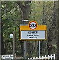
Entering Esher, Copsem Lane
Image: © N Chadwick Taken: 2 Nov 2017
0.21 miles
10
Arbrook Common
Popular area for walkers - near to Esher and Claygate. The clay soils are poorly drained - see the pools beside the clay-surfaced bridleway.
Image: © Colin Smith Taken: 14 Mar 2009
0.22 miles