IMAGES TAKEN NEAR TO
Carleton Close, ESHER, KT10 8EE
Introduction
This page details the photographs taken nearby to Carleton Close, KT10 8EE by members of the Geograph project.
The Geograph project started in 2005 with the aim of publishing, organising and preserving representative images for every square kilometre of Great Britain, Ireland and the Isle of Man.

There are currently over 7.5m images from over14,400 individuals and you can help contribute to the project by visiting https://www.geograph.org.uk
Image Map
Images are licensed for reuse under creativecommons.org/licenses/by-sa/2.0
Notes
- Clicking on the map will re-center to the selected point.
- The higher the marker number, the further away the image location is from the centre of the postcode.
Image Listing (29 Images Found)
Images are licensed for reuse under creativecommons.org/licenses/by-sa/2.0
Image
Details
Distance
1
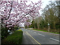
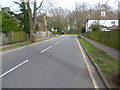
Springtime in Esher
This is Ember Lane just north of Esher station, with Ditton Common on the right. Much of Ditton Common is taken up by the Thames Ditton & Esher Golf Course, although pedestrians have priority over golfers.
Image: © Marathon
Taken: 19 Mar 2014
0.07 miles
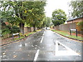
2
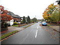
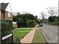
The Woodlands
This is The Woodlands looking towards Ember Lane at the end, with Ditton Common on the other side of Ember Lane. Much of Ditton Common is taken up by the Thames Ditton & Esher Golf Course, although pedestrians have priority over golfers.
Image: © Marathon
Taken: 19 Mar 2014
0.08 miles
3
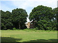
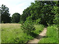
Ditton Common
A large proportion of Ditton Common is the course of the Thames Ditton & Esher Golf Club http://www.thamesdittonandeshergolfclub.com/ .
Image: © Mike Quinn
Taken: 6 Jun 2018
0.14 miles
4
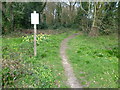
Path on to Ditton Common
This is a path on to Ditton Common from Ember Lane, just north of Esher station. Much of Ditton Common is taken up by the Thames Ditton & Esher Golf Course, although pedestrians have priority over golfers.
Image: © Marathon
Taken: 19 Mar 2014
0.14 miles
7
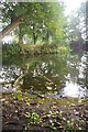
Near the River Ember
South East of the Island Barn reservoir and North of Esher station is a recreational ground with this meandering stream
Image: © steve
Taken: 4 Sep 2005
0.19 miles