IMAGES TAKEN NEAR TO
Mill Road, ESHER, KT10 8DX
Introduction
This page details the photographs taken nearby to Mill Road, KT10 8DX by members of the Geograph project.
The Geograph project started in 2005 with the aim of publishing, organising and preserving representative images for every square kilometre of Great Britain, Ireland and the Isle of Man.

There are currently over 7.5m images from over14,400 individuals and you can help contribute to the project by visiting https://www.geograph.org.uk
Image Map
Images are licensed for reuse under creativecommons.org/licenses/by-sa/2.0
Notes
- Clicking on the map will re-center to the selected point.
- The higher the marker number, the further away the image location is from the centre of the postcode.
Image Listing (47 Images Found)
Images are licensed for reuse under creativecommons.org/licenses/by-sa/2.0
Image
Details
Distance
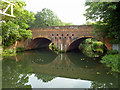
1
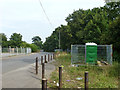
Mill Lane
Looking from the dead-end, the road now accessing industrial estates off to the left which are built on the site of Royal Mills.
Image: © Robin Webster
Taken: 1 Sep 2012
0.05 miles
2
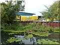
Sandown Industrial Park
Built on the site of Royal Mills. The sheet piling is where the mill stream into the mills was stanked off, although possibly not at the time with this actual piling. Beyond has been filled in.
Image: © Robin Webster
Taken: 1 Sep 2012
0.06 miles
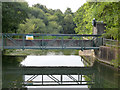
3
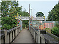
Footbridge with very robust scaffolding
The bridge is over the old course of the River Mole. The scaffolding appears to be a cantilever to support something down below.
Image: © Robin Webster
Taken: 1 Sep 2012
0.07 miles
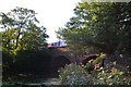
4
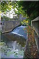
Royal Mills Weir
Near Lower Green North of Esher
Image: © Glyn Baker
Taken: 28 Jul 2010
0.07 miles
5
Railway bridge over earlier course of River Mole
This is not quite the natural course, as it was adjusted here upstream of a mill which was behind the camera. However, it is closer to the natural course than the current main waterway to the west.
Image: © Robin Webster
Taken: 1 Sep 2012
0.07 miles
6
Royal Mills weir
On the old course of the River Mole. The adjustable weir is by Ransoms and Rapier.
Image: © Robin Webster
Taken: 1 Sep 2012
0.08 miles
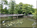
7
Bridge at Royal Mills Weir
Indian Balsam grows beside this tributary to the Mole/Ember
Image: © Glyn Baker
Taken: 28 Jul 2010
0.08 miles
9
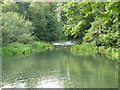
Old course of River Mole
This was the bypass of Royal Mills off to the right, now an industrial estate with no apparent through waterway.
Image: © Robin Webster
Taken: 1 Sep 2012
0.08 miles
10
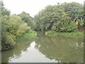
River Mole below Royal Mills weir at Esher
After the Ember/Mole Flood Relief Channel was completed in the mid 1980s, most water now goes down that with just a small "sweetening flow" down this short surviving section of the original river channel. Historically this pool and the relatively natural channel downstream received all or nearly all of the flow of the river http://www.geograph.org.uk/photo/3639064. Today the pool contains still water and the channel downstream is very shallow.
Image: © David Leeming
Taken: 26 Sep 2013
0.10 miles