IMAGES TAKEN NEAR TO
Sandyford, PRESTWICK, KA9 2SP
Introduction
This page details the photographs taken nearby to Sandyford, KA9 2SP by members of the Geograph project.
The Geograph project started in 2005 with the aim of publishing, organising and preserving representative images for every square kilometre of Great Britain, Ireland and the Isle of Man.

There are currently over 7.5m images from over14,400 individuals and you can help contribute to the project by visiting https://www.geograph.org.uk
Image Map
Images are licensed for reuse under creativecommons.org/licenses/by-sa/2.0
Notes
- Clicking on the map will re-center to the selected point.
- The higher the marker number, the further away the image location is from the centre of the postcode.
Image Listing (14 Images Found)
Images are licensed for reuse under creativecommons.org/licenses/by-sa/2.0
Image
Details
Distance
3
Approach Lights for Prestwick Airport
Looking over the A77 to the Airport.
Image: © Billy McCrorie
Taken: 14 Oct 2014
0.08 miles
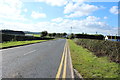
4
Approaching yet another island
Not quite the final island in our journey and I stopped taking photographs at this point. This meant I missed out on some grid squares I thought I had already covered. Oh well will have to come back to complete the round trip.
Image: © Malcolm Neal
Taken: 9 Apr 2019
0.10 miles
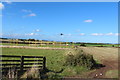
5
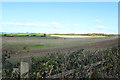
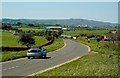
Farmland at Sandyford
The road you see is the A77.
Image: © Billy McCrorie
Taken: 14 Oct 2014
0.10 miles
7
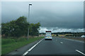
Heavy clouds over the road
A very different outlook compared to my previous submission for this square as the bright blue sky has been replaced with heavy cloud.
Image: © Malcolm Neal
Taken: 28 Aug 2019
0.11 miles
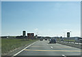
8
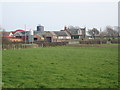
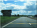
Sandyford Roundabout
Picture taken from Shields Farm access road, looking east towards the Sandyford Roundabout
Image: © Brian Wotherspoon
Taken: 23 Feb 2007
0.12 miles
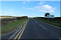
10
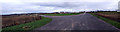
Towards Sandyford Toll
Looking down the A719 from the large lay-by on the right, towards Sandyford Toll. This is a well-used lay-by, especially when there are any interesting aircraft at Prestwick Airport, in the next few squares. Brown Carrick Hill is on the skyline, with its 3 radio masts making it a prominent local landmark.
Image: © Mary and Angus Hogg
Taken: 12 May 2009
0.13 miles