IMAGES TAKEN NEAR TO
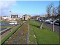
Seabank Road, AYR, KA7 1JE
Introduction
This page details the photographs taken nearby to Seabank Road, KA7 1JE by members of the Geograph project.
The Geograph project started in 2005 with the aim of publishing, organising and preserving representative images for every square kilometre of Great Britain, Ireland and the Isle of Man.

There are currently over 7.5m images from over14,400 individuals and you can help contribute to the project by visiting https://www.geograph.org.uk
Image Map
Images are licensed for reuse under creativecommons.org/licenses/by-sa/2.0
Notes
- Clicking on the map will re-center to the selected point.
- The higher the marker number, the further away the image location is from the centre of the postcode.
Image Listing (335 Images Found)
Images are licensed for reuse under creativecommons.org/licenses/by-sa/2.0
Image
Details
Distance
1
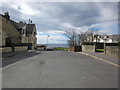
Seabank Road
From the junction with Arran Terrace with view over to the Isle of Arran.
Image: © Billy McCrorie
Taken: 31 Mar 2012
0.01 miles
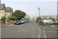
2
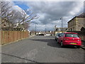
Seabank Road
Going towards Montgomerie Terrace.
Image: © Billy McCrorie
Taken: 31 Mar 2012
0.01 miles
3
Path from Seabank Road
View over the sea to Arran.
Image: © Billy McCrorie
Taken: 31 Mar 2012
0.02 miles
4
Arran Terrace
Taken from Montgomerie Terrace.
Image: © Billy McCrorie
Taken: 31 Mar 2012
0.02 miles
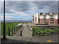
5
Seafront Car Park
From the path at the end of Seabank Road.
Image: © Billy McCrorie
Taken: 31 Mar 2012
0.03 miles
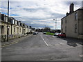
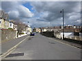
6
Montgomerie Terrace, Ayr
From the junction with Arran Terrace. End of the road is a Sea Mist (haar) moving in.
Image: © Billy McCrorie
Taken: 7 Sep 2021
0.03 miles
7
Montgomerie Terrace
From the junction with Arran Terrace.
Image: © Billy McCrorie
Taken: 31 Mar 2012
0.04 miles
8
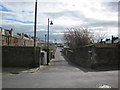
Eglinton Place
From Montgomerie Terrace.
Image: © Billy McCrorie
Taken: 31 Mar 2012
0.05 miles
9
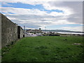
The Citadel Wall
This is a remaining part of the citadel which Oliver Cromwell built in 1652-53. Arran Terrace, on the right, was inside the fort and is considerably higher than the car park on the left. The citadel must have been built on an excellent vantage point though, as the trees suggest, it would also be exposed to the prevailing winds.
Image: © Mary and Angus Hogg
Taken: 25 Feb 2009
0.05 miles
10
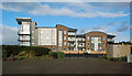
Flats At Ayr Seafront
The most recent development. For a view of the construction site, see Image
Image: © Mary and Angus Hogg
Taken: 18 Nov 2017
0.06 miles