The Citadel Wall
Introduction
The photograph on this page of The Citadel Wall by Mary and Angus Hogg as part of the Geograph project.
The Geograph project started in 2005 with the aim of publishing, organising and preserving representative images for every square kilometre of Great Britain, Ireland and the Isle of Man.

There are currently over 7.5m images from over 14,400 individuals and you can help contribute to the project by visiting https://www.geograph.org.uk
The Citadel Wall
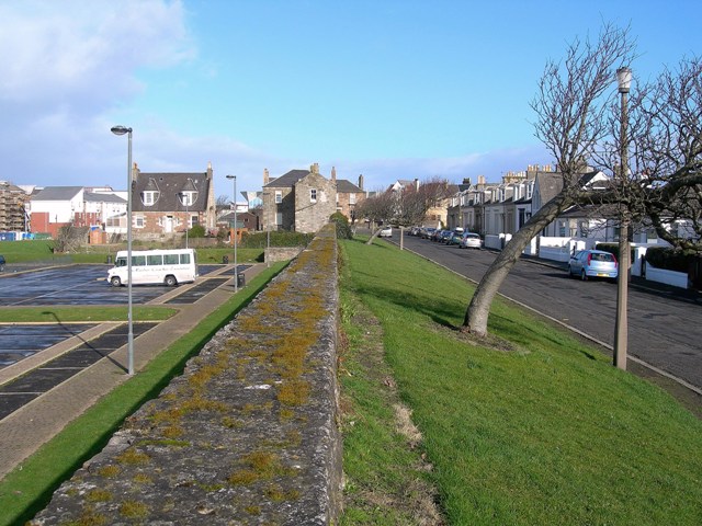
Image: © Mary and Angus Hogg Taken: 25 Feb 2009
This is a remaining part of the citadel which Oliver Cromwell built in 1652-53. Arran Terrace, on the right, was inside the fort and is considerably higher than the car park on the left. The citadel must have been built on an excellent vantage point though, as the trees suggest, it would also be exposed to the prevailing winds.
Images are licensed for reuse under creativecommons.org/licenses/by-sa/2.0
Image Location
Latitude
55.464331
Longitude
-4.638944