IMAGES TAKEN NEAR TO
Assloss Road, KILMARNOCK, KA3 1AN
Introduction
This page details the photographs taken nearby to Assloss Road, KA3 1AN by members of the Geograph project.
The Geograph project started in 2005 with the aim of publishing, organising and preserving representative images for every square kilometre of Great Britain, Ireland and the Isle of Man.

There are currently over 7.5m images from over14,400 individuals and you can help contribute to the project by visiting https://www.geograph.org.uk
Image Map
Images are licensed for reuse under creativecommons.org/licenses/by-sa/2.0
Notes
- Clicking on the map will re-center to the selected point.
- The higher the marker number, the further away the image location is from the centre of the postcode.
Image Listing (30 Images Found)
Images are licensed for reuse under creativecommons.org/licenses/by-sa/2.0
Image
Details
Distance
1
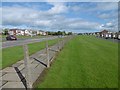
Remains of a fence, Kilmarnock
There was once a fence between Mure Avenue and Western Road (dual carriageway). It has gone which made the crossing easy.
Image: © Richard Webb
Taken: 25 Sep 2015
0.11 miles
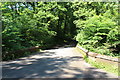
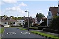
4
The Glasgow Road
Coming up to an island on the Glasgow Road, with very little traffic visible.
Image: © Malcolm Neal
Taken: 20 Mar 2022
0.12 miles
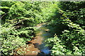
9
Rowallan Drive
This was the only street in the development shown on the Provisional 1:25,000 map published in 1954.
Image: © Richard Webb
Taken: 25 Sep 2015
0.15 miles