IMAGES TAKEN NEAR TO
Barr, GIRVAN, KA26 9UA
Introduction
This page details the photographs taken nearby to KA26 9UA by members of the Geograph project.
The Geograph project started in 2005 with the aim of publishing, organising and preserving representative images for every square kilometre of Great Britain, Ireland and the Isle of Man.

There are currently over 7.5m images from over14,400 individuals and you can help contribute to the project by visiting https://www.geograph.org.uk
Image Map
Images are licensed for reuse under creativecommons.org/licenses/by-sa/2.0
Notes
- Clicking on the map will re-center to the selected point.
- The higher the marker number, the further away the image location is from the centre of the postcode.
Image Listing (26 Images Found)
Images are licensed for reuse under creativecommons.org/licenses/by-sa/2.0
Image
Details
Distance
1
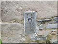
Ordnance Survey Flush Bracket S5128
This bracket can be found on the wall of aroadside building at North Balloch. The benchmark height is recorded as being 149.2094 metres above sea level. For more detail see : http://www.bench-marks.org.uk/bm20796
Image: © Peter Wood
Taken: 15 Sep 2017
0.01 miles
2
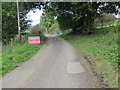
Road under repair at North Balloch
Looking north-westward.
Image: © Peter Wood
Taken: 15 Sep 2017
0.04 miles
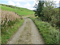
3
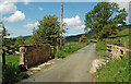
Leaving North Balloch
This road continues to Crosshill in the Girvan Valley. It is used by National Cycle Route No7.
Image: © Mary and Angus Hogg
Taken: 10 Jun 2019
0.05 miles
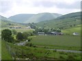
7
Track from North Balloch to White Row Farm
Looking eastward.
Image: © Peter Wood
Taken: 15 Sep 2017
0.10 miles
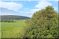
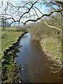
8
Erosion And Deposition In The Stinchar Valley
The old fence line shows where the edge of the field used to be. The faster-flowing water on the outer edge of the bend has eroded the field, while the slower water on the inside edge has deposited the stones.
Image: © Mary and Angus Hogg
Taken: 10 Jun 2019
0.11 miles
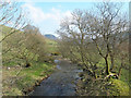
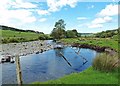
9

In The Stinchar Valley
Looking downstream near North Balloch. The river level was very low after a long spell of dry spring weather.
Image: © Mary and Angus Hogg
Taken: 10 Jun 2019
0.12 miles