Erosion And Deposition In The Stinchar Valley
Introduction
The photograph on this page of Erosion And Deposition In The Stinchar Valley by Mary and Angus Hogg as part of the Geograph project.
The Geograph project started in 2005 with the aim of publishing, organising and preserving representative images for every square kilometre of Great Britain, Ireland and the Isle of Man.

There are currently over 7.5m images from over 14,400 individuals and you can help contribute to the project by visiting https://www.geograph.org.uk
Erosion And Deposition In The Stinchar Valley
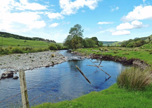
Image: © Mary and Angus Hogg Taken: 10 Jun 2019
The old fence line shows where the edge of the field used to be. The faster-flowing water on the outer edge of the bend has eroded the field, while the slower water on the inside edge has deposited the stones.
Images are licensed for reuse under creativecommons.org/licenses/by-sa/2.0
Image Location
Latitude
55.227574
Longitude
-4.63