IMAGES TAKEN NEAR TO
Ballantrae, GIRVAN, KA26 0PB
Introduction
This page details the photographs taken nearby to KA26 0PB by members of the Geograph project.
The Geograph project started in 2005 with the aim of publishing, organising and preserving representative images for every square kilometre of Great Britain, Ireland and the Isle of Man.

There are currently over 7.5m images from over14,400 individuals and you can help contribute to the project by visiting https://www.geograph.org.uk
Image Map
Images are licensed for reuse under creativecommons.org/licenses/by-sa/2.0
Notes
- Clicking on the map will re-center to the selected point.
- The higher the marker number, the further away the image location is from the centre of the postcode.
Image Listing (125 Images Found)
Images are licensed for reuse under creativecommons.org/licenses/by-sa/2.0
Image
Details
Distance

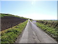
3
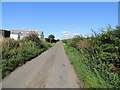
Road to Garleffin
Also part of the Ayrshire Coastal Path.
Image: © Billy McCrorie
Taken: 18 Aug 2012
0.03 miles
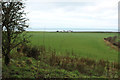
5
Farmland at Kinniegar
From the Ayrshire Coastal Path.
Image: © Billy McCrorie
Taken: 18 Aug 2012
0.06 miles
6
Road to Langdale Farm
Also part of the Ayrshire Coastal Path.
Image: © Billy McCrorie
Taken: 18 Aug 2012
0.07 miles
7
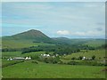
Lower Stinchar Valley
Looking up the Stinchar Valley from Knockenfinnick, with Knockdolian on the left.
Image: © Mary and Angus Hogg
Taken: 17 Jun 2007
0.08 miles
8
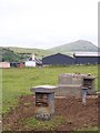
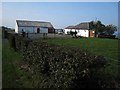
Ballantrae ROC Post
In use between 1963 and 1968 and again between 1974 and 1991, this is one of over 300 Royal Observer Corps (ROC) posts across Scotland. In the Cold War era the job of the ROC was to report the positions of the nuclear bomb strikes and monitor resulting fallout areas and relay these back to Group Headquarters.
Image: © James T M Towill
Taken: 20 Jun 2009
0.09 miles
9
Farmland at Kinniegar
With view of Ballantrae in the distance.
Image: © Billy McCrorie
Taken: 6 Jan 2016
0.11 miles
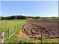
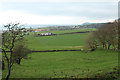
10
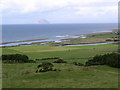
Pasture at Kinniegar
Open fields with a view of the river Stinchar meeting the sea, top of photo is the Ailsa Craig.
Image: © Billy McCrorie
Taken: 27 Aug 2006
0.15 miles