IMAGES TAKEN NEAR TO
KA2 0YF
Introduction
This page details the photographs taken nearby to KA2 0YF by members of the Geograph project.
The Geograph project started in 2005 with the aim of publishing, organising and preserving representative images for every square kilometre of Great Britain, Ireland and the Isle of Man.

There are currently over 7.5m images from over14,400 individuals and you can help contribute to the project by visiting https://www.geograph.org.uk
Image Map
Images are licensed for reuse under creativecommons.org/licenses/by-sa/2.0
Notes
- Clicking on the map will re-center to the selected point.
- The higher the marker number, the further away the image location is from the centre of the postcode.
Image Listing (88 Images Found)
Images are licensed for reuse under creativecommons.org/licenses/by-sa/2.0
Image
Details
Distance
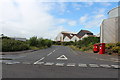
3
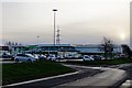
Road passing Superstores, Kilmarnock
Image: © Billy McCrorie
Taken: 21 Aug 2013
0.11 miles
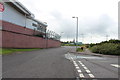
4
Road behind ASDA
Road part of a bus route.
Image: © Billy McCrorie
Taken: 21 Aug 2013
0.12 miles
5
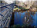
River Irvine, Kilmarnock
Locked off pedestrian bridge? Near Glenfield Works.
Image: © wfmillar
Taken: 10 Nov 2011
0.13 miles
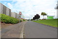
6
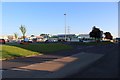
ASDA superstore, Kilmarnock
A large ASDA supermarket located on Queen's Drive Retail Park in Kilmarnock.
Image: © Graham Robson
Taken: 27 Jun 2019
0.13 miles
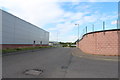
8
Compass Self-drive
Car-rental on Low Glencairn Street. Backed by part of an electricity sub-station.
Image: © M J Richardson
Taken: 26 Jun 2013
0.13 miles
10
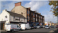
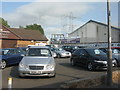
Low Glencairn Street
The Burns Inn pub is nearest the camera. This block of the street survives at the edge of a retail park car park.
Image: © Thomas Nugent
Taken: 27 Oct 2010
0.14 miles