Low Glencairn Street
Introduction
The photograph on this page of Low Glencairn Street by Thomas Nugent as part of the Geograph project.
The Geograph project started in 2005 with the aim of publishing, organising and preserving representative images for every square kilometre of Great Britain, Ireland and the Isle of Man.

There are currently over 7.5m images from over 14,400 individuals and you can help contribute to the project by visiting https://www.geograph.org.uk
Low Glencairn Street
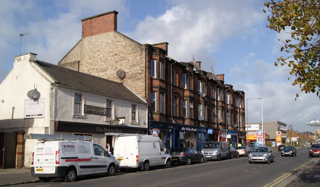
Image: © Thomas Nugent Taken: 27 Oct 2010
The Burns Inn pub is nearest the camera. This block of the street survives at the edge of a retail park car park.
Images are licensed for reuse under creativecommons.org/licenses/by-sa/2.0
Image Location
Latitude
55.599267
Longitude
-4.496709