IMAGES TAKEN NEAR TO
Kirkmichael, MAYBOLE, KA19 7LS
Introduction
This page details the photographs taken nearby to KA19 7LS by members of the Geograph project.
The Geograph project started in 2005 with the aim of publishing, organising and preserving representative images for every square kilometre of Great Britain, Ireland and the Isle of Man.

There are currently over 7.5m images from over14,400 individuals and you can help contribute to the project by visiting https://www.geograph.org.uk
Image Map
Images are licensed for reuse under creativecommons.org/licenses/by-sa/2.0
Notes
- Clicking on the map will re-center to the selected point.
- The higher the marker number, the further away the image location is from the centre of the postcode.
Image Listing (12 Images Found)
Images are licensed for reuse under creativecommons.org/licenses/by-sa/2.0
Image
Details
Distance
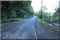
1
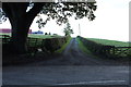
Aitkenhead
Cottage at road junction south of Kirkmichael
Image: © Leslie Barrie
Taken: 29 Sep 2013
0.08 miles
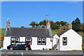
2
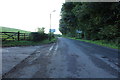
The junction at Aitkenhead
The junction at Aitkenhead from the top of a telephone pole
Image: © David Johnston
Taken: 8 Apr 2008
0.09 miles
3
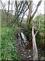
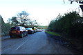
The Remains of a Mill Lade?
Intrigued by the reference to a Waulk Mill near Kirkmichael Image which gave its name to a bridge over the Water of Girvan Image, I searched a site shown as a mill on a 1902 OS map. There's no evidence of a building but I found what looks like an old lade on the south side of the river, near Arnsow Farm. Although now much silted-up, this channel would have been capable of powering a water-mill. Aitkenhead Mill lies on the opposite bank at the same fast-flowing section of the river, from which its lade was created.
Image: © Mary and Angus Hogg
Taken: 14 Apr 2014
0.15 miles
7
Kirkmichael Community Garden
Was visited by the Beechgrove gardeners many years ago.
Image: © Billy McCrorie
Taken: 27 Nov 2020
0.24 miles
8
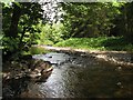
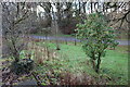
Water of Girvan
A view upstream from Waulk Mill Bridge.
Image: © Jonathan Wilkins
Taken: 25 May 2018
0.24 miles
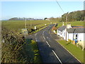
9
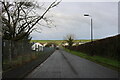
Bolestyle Road, Kirkmichael
With the Primary School on the left.
Image: © Billy McCrorie
Taken: 27 Nov 2020
0.24 miles