IMAGES TAKEN NEAR TO
Manse Road, CUMNOCK, KA18 3SA
Introduction
This page details the photographs taken nearby to Manse Road, KA18 3SA by members of the Geograph project.
The Geograph project started in 2005 with the aim of publishing, organising and preserving representative images for every square kilometre of Great Britain, Ireland and the Isle of Man.

There are currently over 7.5m images from over14,400 individuals and you can help contribute to the project by visiting https://www.geograph.org.uk
Image Map
Images are licensed for reuse under creativecommons.org/licenses/by-sa/2.0
Notes
- Clicking on the map will re-center to the selected point.
- The higher the marker number, the further away the image location is from the centre of the postcode.
Image Listing (24 Images Found)
Images are licensed for reuse under creativecommons.org/licenses/by-sa/2.0
Image
Details
Distance
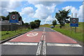
4
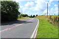
Approaching Muirkirk form the east
The A71 links the M74 with Ayrshire. 'Scots Leid' seems to be a reference to the local Scots dialect spoken in the toun of Muirkirk (probably pronounced Moorkurk).
Image: © Robert Murray
Taken: 20 Mar 2016
0.04 miles
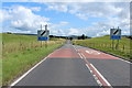
7
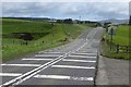
A70, Muirkirk
The eastern approaches to Muirkirk. The remains of the bridge on the short-lived (and never opened in its entirety) Spireslack Branch can be seen in the distance.
Image: © Richard Webb
Taken: 7 Jun 2015
0.06 miles
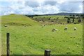
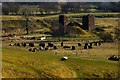
8
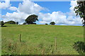
The Haw Burn
As it approaches the River Ayr. Tor Hill is on the left of the photo.
Image: © Robert Murray
Taken: 20 Mar 2016
0.07 miles
9
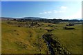
Remaining piers of viaduct
See Image for more information on this once viaduct. Aerial images show the random Boulders/stones in the foreground are laid out in the form of a christian cross.
Image: © Robert Murray
Taken: 20 Mar 2016
0.12 miles
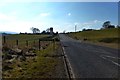
10
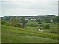
The Old Viaduct
This viaduct was part of the former Caledonian Railway Company's line. The route followed by the line is still clear on the ground, but the viaduct was blown up during the Second World War, as military practice in using explosives. (Source: "The River Ayr Way", by Dane Love)
Image: © Mary and Angus Hogg
Taken: 10 Jun 2007
0.14 miles