IMAGES TAKEN NEAR TO
Mountcastle Wynd, KILWINNING, KA13 6DH
Introduction
This page details the photographs taken nearby to Mountcastle Wynd, KA13 6DH by members of the Geograph project.
The Geograph project started in 2005 with the aim of publishing, organising and preserving representative images for every square kilometre of Great Britain, Ireland and the Isle of Man.

There are currently over 7.5m images from over14,400 individuals and you can help contribute to the project by visiting https://www.geograph.org.uk
Image Map
Images are licensed for reuse under creativecommons.org/licenses/by-sa/2.0
Notes
- Clicking on the map will re-center to the selected point.
- The higher the marker number, the further away the image location is from the centre of the postcode.
Image Listing (5 Images Found)
Images are licensed for reuse under creativecommons.org/licenses/by-sa/2.0
Image
Details
Distance
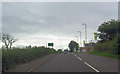
1
A737 crosses railway bridge north of Kilwinning
Image: © Colin Pyle
Taken: 10 Jun 2015
0.12 miles
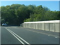
2
A737 outside Kilwinning
Approaching the bridge over the Glasgow to Ayr line.
Image: © Gordon Dowie
Taken: 2 May 2010
0.19 miles
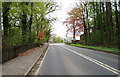
3
North End of Whitehirst Park Road
Laigh Smithstone Farm is on the hill. The roundabout is the last before leaving the housing estate.
Image: © wfmillar
Taken: 14 May 2009
0.20 miles
4
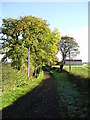
The Barn
Track to Wood Farm and red roofed barn.
Image: © Chris Court
Taken: 13 Oct 2005
0.24 miles