IMAGES TAKEN NEAR TO
ELGIN, IV30 8XT
Introduction
This page details the photographs taken nearby to IV30 8XT by members of the Geograph project.
The Geograph project started in 2005 with the aim of publishing, organising and preserving representative images for every square kilometre of Great Britain, Ireland and the Isle of Man.

There are currently over 7.5m images from over14,400 individuals and you can help contribute to the project by visiting https://www.geograph.org.uk
Image Map
Images are licensed for reuse under creativecommons.org/licenses/by-sa/2.0
Notes
- Clicking on the map will re-center to the selected point.
- The higher the marker number, the further away the image location is from the centre of the postcode.
Image Listing (17 Images Found)
Images are licensed for reuse under creativecommons.org/licenses/by-sa/2.0
Image
Details
Distance
2
Fundamental bench mark, Quarrelwood, Morayshire
The block is now used as a passive GPS station. Its auxiliary lies approximately 250m to the NE: Image
Image: © Claire Pegrum
Taken: 21 Aug 2020
0.17 miles
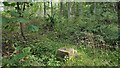
3
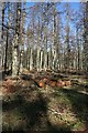
Logs by the Track
A few logs seem to have been overlooked when the forest thinnings were removed.
Image: © Anne Burgess
Taken: 9 Mar 2010
0.18 miles
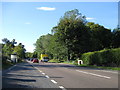
4
Start of the line!
The head of the tramway, as it appears now, that ran down from Newton Quarry across the main road (behind me), along the west side of Newton Tollhouse (where there was a water tank and coal replenishment site judging by remaining structures and loads of ashes onsite) and then continuing south through the woods, along the cutting and over an embankment to meet up with the main rail-line at Lineside. The tramway was laid in the late 1890's/early 1900's - I don't know for sure when it was lifted. Out of sight on the left is the mahoosive hole in the ground that gave birth to Laurencekirk church in Forres amongst other places.
Image: © Dick Pearce
Taken: 18 Apr 2011
0.19 miles
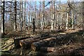
5
Quarrel Wood
A few logs, left behind from thinning of the forest, lie beside the track to the gate beside Ardgilzean.
Image: © Anne Burgess
Taken: 9 Mar 2010
0.19 miles
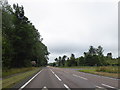
6
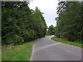
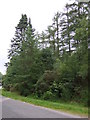
Minor road towards Quarrywood
Heading north.
Image: © JThomas
Taken: 19 Jul 2014
0.19 miles
7
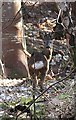
Roe Deer (Capreolus capreolus)
Not the sharpest of images, but this is a roe deer watching me in Quarrel Wood. In my experience it's unusual to see more than the rear end of a roe deer!
Image: © Anne Burgess
Taken: 9 Mar 2010
0.20 miles
9
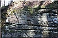
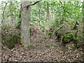
Sandstone Outcrop
The undulating surface in the centre of this rock face shows where the underlying surface of sand was scoured out by water before more sand was laid down, infilling the channel.
Image: © Anne Burgess
Taken: 9 Mar 2010
0.21 miles