Sandstone Outcrop
Introduction
The photograph on this page of Sandstone Outcrop by Anne Burgess as part of the Geograph project.
The Geograph project started in 2005 with the aim of publishing, organising and preserving representative images for every square kilometre of Great Britain, Ireland and the Isle of Man.

There are currently over 7.5m images from over 14,400 individuals and you can help contribute to the project by visiting https://www.geograph.org.uk
Sandstone Outcrop
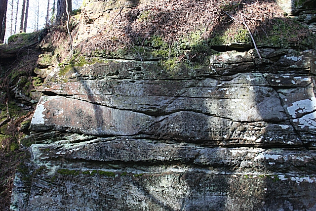
Image: © Anne Burgess Taken: 9 Mar 2010
The undulating surface in the centre of this rock face shows where the underlying surface of sand was scoured out by water before more sand was laid down, infilling the channel.
Images are licensed for reuse under creativecommons.org/licenses/by-sa/2.0
Image Location
Latitude
57.651988
Longitude
-3.387198