IMAGES TAKEN NEAR TO
Cockburn Place, ELGIN, IV30 4HZ
Introduction
This page details the photographs taken nearby to Cockburn Place, IV30 4HZ by members of the Geograph project.
The Geograph project started in 2005 with the aim of publishing, organising and preserving representative images for every square kilometre of Great Britain, Ireland and the Isle of Man.

There are currently over 7.5m images from over14,400 individuals and you can help contribute to the project by visiting https://www.geograph.org.uk
Image Map
Images are licensed for reuse under creativecommons.org/licenses/by-sa/2.0
Notes
- Clicking on the map will re-center to the selected point.
- The higher the marker number, the further away the image location is from the centre of the postcode.
Image Listing (24 Images Found)
Images are licensed for reuse under creativecommons.org/licenses/by-sa/2.0
Image
Details
Distance
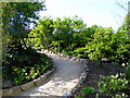
1
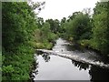
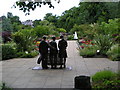
River Lossie
View from Deanshaugh Bridge in Cooper Park.
Image: © Richard Webb
Taken: 6 Aug 2011
0.07 miles
2
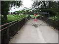
Deanshaugh Bridge
Closed roads are far more of a nuisance than they used to be - many journeys are affected. When rushing for a train, you do not need this. Perhaps some warning beforehand would be a good idea. This time finding a new route was easy.
I hope there was a Good Reason for this, but suspect otherwise.
Image: © Richard Webb
Taken: 6 Aug 2011
0.07 miles
4
Bridge over the River Lossie
For pedestrians and cyclists only; route for National Cycle Route 1 goes over it.
Image: © Iain Macaulay
Taken: 4 Dec 2008
0.08 miles
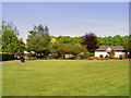
6
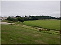
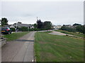
Playing field off Deanhaugh Road, Elgin
Image: © Richard Webb
Taken: 25 Aug 2021
0.11 miles
7
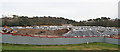
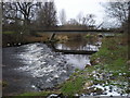
Flood Defence Work
I am a little puzzled by this. It is shown as a playing field on the map, but it is now full of heaps of earth and sand. It is part of the work associated with the flood defence project, but I have yet to learn how it fits into the grand scheme of things.
Image: © Anne Burgess
Taken: 7 Apr 2014
0.11 miles
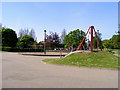
10
Cooper Park
The building to the right is the public conveniences.
Image: © Ann Harrison
Taken: 19 May 2008
0.20 miles