IMAGES TAKEN NEAR TO
Cadboll Wood, INVERGORDON, IV18 0PN
Introduction
This page details the photographs taken nearby to IV18 0PN by members of the Geograph project.
The Geograph project started in 2005 with the aim of publishing, organising and preserving representative images for every square kilometre of Great Britain, Ireland and the Isle of Man.

There are currently over 7.5m images from over14,400 individuals and you can help contribute to the project by visiting https://www.geograph.org.uk
Image Map (Loading...)


Getting Data...Please wait
Leaflet Map data © OpenStreetMap
Images are licensed for reuse under creativecommons.org/licenses/by-sa/2.0
Notes
- Clicking on the map will re-center to the selected point.
- The higher the marker number, the further away the image location is from the centre of the postcode.
Image Listing (14 Images Found)
Images are licensed for reuse under creativecommons.org/licenses/by-sa/2.0
Image
Details
Distance
1
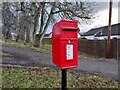
Postbox at Milnafua
IV17 11D. Royal Mail list this box as 'Milnafua'.
Image: © David Bremner
Taken: 29 Jan 2023
0.02 miles
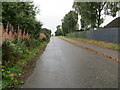
2
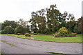
Milnafua
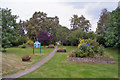
A view from within the estate to the community-created gardens at its entrance.
More information: Image
Image: © Richard Dorrell
Taken: 4 Oct 2016
0.02 miles
4
Milnafua
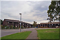
Part of the Milnafua Housing Estate, located on the eastern edge of Alness.
The estate has a community-created garden entrance> See: Image
Image: © Richard Dorrell
Taken: 4 Oct 2016
0.04 miles
5
Milnafua
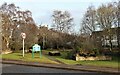
The information board (visible in this image) states: 'The Milnafua Housing Estate with some 200 houses is now a Social Inclusion Area with special emphasis on the 14 to 25 age group. Over the years, Milnafua had many problems especially with vandalism. A 'local group' was formed and made it a priority to tidy up the entrance to the estate...regular volunteers who undertook this challenge were all residents of the estate, and many of them were aged four to sixteen...the very hard work and effort and enthusiasm of the young people cannot be measured"
See also: Image], and Image
Image: © Richard Dorrell
Taken: 4 Oct 2016
0.04 miles
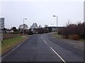
9
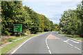
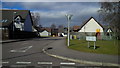
The former route of the A9 at Milnafua, Alness
Looking south-westward.
Image: © Peter Wood
Taken: 9 Sep 2021
0.08 miles