IMAGES TAKEN NEAR TO
Chestnut Road, DINGWALL, IV15 9UQ
Introduction
This page details the photographs taken nearby to Chestnut Road, IV15 9UQ by members of the Geograph project.
The Geograph project started in 2005 with the aim of publishing, organising and preserving representative images for every square kilometre of Great Britain, Ireland and the Isle of Man.

There are currently over 7.5m images from over14,400 individuals and you can help contribute to the project by visiting https://www.geograph.org.uk
Image Map (Loading...)


Getting Data...Please wait
Leaflet Map data © OpenStreetMap
Images are licensed for reuse under creativecommons.org/licenses/by-sa/2.0
Notes
- Clicking on the map will re-center to the selected point.
- The higher the marker number, the further away the image location is from the centre of the postcode.
Image Listing (10 Images Found)
Images are licensed for reuse under creativecommons.org/licenses/by-sa/2.0
Image
Details
Distance
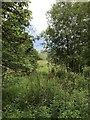
1
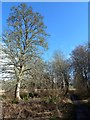
Jubilee Wood, Dingwall
This small natural wooded area beside the River Peffery had additional trees planted to mark the Queen's Silver Jubilee in 1977. The site was developed by the Scottish Wildlife Trust.
Image: © Mary and Angus Hogg
Taken: 28 Mar 2013
0.10 miles
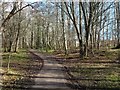
3
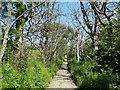
Beside a woodland path, Lower Docharty
By a connecting footpath to the Round Dingwall walking route.
Image: © Julian Paren
Taken: 28 Jun 2019
0.18 miles
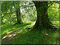
4
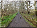
Part of the Round Dingwall walk
This straight section of path takes the circular walk behind Tulloch Castle.
Image: © Julian Paren
Taken: 28 Jun 2019
0.18 miles
5
Heading west on the track from Tulloch Castle
Image: © Alpin Stewart
Taken: 3 Apr 2015
0.19 miles
6
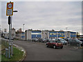
Dingwall Primary School
Located in Ross Place, north of the town centre. This is a large primary school with some 425 pupils on roll. The 20mph speed restriction operates on local roads at times when pupils are coming and going. Restrictions of this kind are common to almost all schools within the Highland Education Authority.
Image: © Richard Dorrell
Taken: 17 Jan 2013
0.21 miles
7
Jubilee Wood, Dingwall
The edge of a small natural wooded area which had additional trees planted to mark the Queen's Silver Jubilee in 1977.
Image: © Mary and Angus Hogg
Taken: 28 Mar 2013
0.21 miles
8
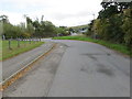
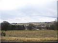
Dochcarty Brae joining Dochcarty Road on the outskirts of Dingwall
Looking south-eastward.
Image: © Peter Wood
Taken: 27 Sep 2018
0.24 miles
9
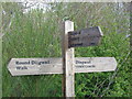
Signpost for the Round Dingwall Walk
This signpost is on Docharty Road, Dingwall. It indicates the junction for the route to the Heights of Fodderty and Achterneed. It is part of the Mid-Ross Paths around Dingwall, network.
Image: © Alasdair Macdonald
Taken: 12 May 2006
0.25 miles