IMAGES TAKEN NEAR TO
NAIRN, IV12 5XB
Introduction
This page details the photographs taken nearby to IV12 5XB by members of the Geograph project.
The Geograph project started in 2005 with the aim of publishing, organising and preserving representative images for every square kilometre of Great Britain, Ireland and the Isle of Man.

There are currently over 7.5m images from over14,400 individuals and you can help contribute to the project by visiting https://www.geograph.org.uk
Image Map
Images are licensed for reuse under creativecommons.org/licenses/by-sa/2.0
Notes
- Clicking on the map will re-center to the selected point.
- The higher the marker number, the further away the image location is from the centre of the postcode.
Image Listing (6 Images Found)
Images are licensed for reuse under creativecommons.org/licenses/by-sa/2.0
Image
Details
Distance
1
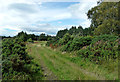
Track Near The Mount
An access track on the other side of the road from The Mount.
Image: © Mary and Angus Hogg
Taken: 31 Jul 2018
0.10 miles
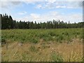
2
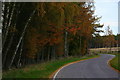
Looking northwestwards along Airdrie Woods near Mount.
Image: © Des Colhoun
Taken: 5 Nov 2006
0.13 miles
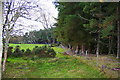
4
Airdrie Plantations
Recently replanted block.
Image: © Richard Webb
Taken: 5 Aug 2014
0.21 miles
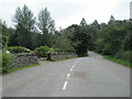
5
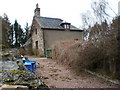
Airdrie Mill Cottage
I asked if there was anything left of the mill and was told there was some old ruins down by the burn below house. There was no access to ruins, although I could see down glen to bridges, ponds, paths and burns.
Image: © Sarah McGuire
Taken: 24 Mar 2009
0.22 miles