1
Pooley Weighbridge
On the site of the former Muir-of-Ord to Fortrose Railway, in what would have been the old goods yard, this old railway weighbridge made by Henry Pooley and Son of Liverpool is still in position. I am told the weighbridge office is still intact, with all the workings in situ hidden behind the mass of out of control ivy covering the building.
Image: © valenta
Taken: 27 Apr 2017
0.02 miles
2
Fortrose railway station (site), Highland
Opened in 1894 as the terminus of the Highland Railway's branch line from Muir of Ord, this station closed in 1951 to passengers and completely in 1960.
View north across the old station forecourt towards the end of the platform and the buffers, with the station building having been to the extreme left. The former weighbridge in the foreground appears to be the only visible evidence of what was here before.
Image: © Nigel Thompson
Taken: 31 Mar 2015
0.02 miles
3
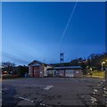
Fortrose Fire Station
Located at the junction of Station Crescent and Station Road, an aircraft contrail visible in the dusk sky
Image: © valenta
Taken: 30 Nov 2019
0.03 miles
4
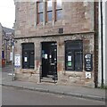
Fortrose Free Church, Church Street, Fortrose
The congregation is part of the Free Church of Scotland: https://en.wikipedia.org/wiki/Free_Church_of_Scotland_(since_1900) . Nearly 11000 people declared their affiliation to the Free Church in the 2011 Scottish census.
Image: © Bill Harrison
Taken: 17 Apr 2022
0.04 miles
5
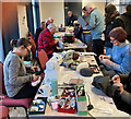
Repair Cafe, Fortrose Free Church
Each month volunteers help to repair items brought in for assessment, while refreshments are provided for those waiting. This is part of the Highland Community Waste Partnership's activities across the Highlands. The idea is to teach the repair tricks as well as to repair the items, so the owner can go home with some new skills. The Black Isle cafes are supported by the Black Isle's Mens Shed and Transition Black Isle. Each month there is a different village for the event. Funding for the three year programme comes from the Scottish Government through Keep Scotland Beautiful. The funding exists to help reduce the carbon footprint of Scotland through reuse, repair and recycle activities.
Image: © Julian Paren
Taken: 7 Jan 2023
0.04 miles
6
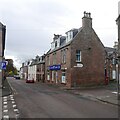
Fortrose : Station Road
Looking up Station Road from the High Street.
Image: © Lewis Clarke
Taken: 23 Apr 2016
0.04 miles
7
Bakery, Fortrose
Image: © Richard Webb
Taken: 25 Oct 2020
0.04 miles
8
High Street, Fortrose
Image: © Richard Webb
Taken: 25 Oct 2020
0.05 miles
9
Fortrose Free Church
Recently constructed Free Church, just below the Town Hall on Church Street
Image: © valenta
Taken: 12 Jul 2019
0.05 miles
10
Fortrose Town Hall
Originally built as a church in 1839-41, it was abandoned as a church and now serves as the town hall
https://britishlistedbuildings.co.uk/200373155-fortrose-church-street-town-hall-fortrose
Image: © valenta
Taken: 12 Jul 2019
0.05 miles


