IMAGES TAKEN NEAR TO
The Causeway, IPSWICH, IP7 7LJ
Introduction
This page details the photographs taken nearby to The Causeway, IP7 7LJ by members of the Geograph project.
The Geograph project started in 2005 with the aim of publishing, organising and preserving representative images for every square kilometre of Great Britain, Ireland and the Isle of Man.

There are currently over 7.5m images from over14,400 individuals and you can help contribute to the project by visiting https://www.geograph.org.uk
Image Map
Images are licensed for reuse under creativecommons.org/licenses/by-sa/2.0
Notes
- Clicking on the map will re-center to the selected point.
- The higher the marker number, the further away the image location is from the centre of the postcode.
Image Listing (11 Images Found)
Images are licensed for reuse under creativecommons.org/licenses/by-sa/2.0
Image
Details
Distance
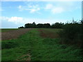
5
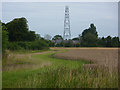
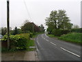
Footpath east of Hitcham Causeway
Looking towards a mast in the next square to the northwest. The path runs roughly parallel to the B1115 for some distance.
Image: © Andrew Hill
Taken: 5 Aug 2009
0.17 miles
6
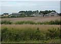
Fields looking towards farm buildings
Oil seed rape awaits harvest in the foreground, the conditions have caused delays this year. Looking towards a farm on Hitcham Causeway.
Image: © Andrew Hill
Taken: 5 Aug 2009
0.17 miles
7
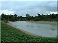
Low Water
Low Water at The Hobbets as marked on the Ordnance Survey maps.This is a farmers irrigation reservoir http://www.geograph.org.uk/photo/252394.
Image: © Keith Evans
Taken: 1 Oct 2006
0.22 miles
8
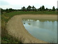
Low Water
Low Water at The Hobbets as marked on the Ordnance Survey maps. This is a farmers irrigation reservoir http://www.geograph.org.uk/photo/252393.
Image: © Keith Evans
Taken: 1 Oct 2006
0.22 miles
9
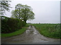
Footpath to the Hobbets
Footpath to the Hobbets as marked on Ordnance Survey maps near to Hitcham Suffolk.
Image: © Keith Evans
Taken: 1 Oct 2006
0.23 miles
10
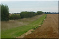
Field edge
The margin is shown on the 1:25,000 map.
Image: © Andrew Hill
Taken: 5 Aug 2009
0.24 miles