IMAGES TAKEN NEAR TO
Parsonage Lane, IPSWICH, IP7 7HT
Introduction
This page details the photographs taken nearby to Parsonage Lane, IP7 7HT by members of the Geograph project.
The Geograph project started in 2005 with the aim of publishing, organising and preserving representative images for every square kilometre of Great Britain, Ireland and the Isle of Man.

There are currently over 7.5m images from over14,400 individuals and you can help contribute to the project by visiting https://www.geograph.org.uk
Image Map
Images are licensed for reuse under creativecommons.org/licenses/by-sa/2.0
Notes
- Clicking on the map will re-center to the selected point.
- The higher the marker number, the further away the image location is from the centre of the postcode.
Image Listing (41 Images Found)
Images are licensed for reuse under creativecommons.org/licenses/by-sa/2.0
Image
Details
Distance
1
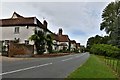
1988 Parsonage Lane Chelsworth (west end) in Autumn
Tucked in at the base of the hill leading north to Bildeston, this lane leads east to Culfens, a boggy area near the river Brett, where it is said that the Vikings built their ships. It is a popular route for walkers (often with their dogs),who sometimes continue up the path opposite the west end of lane, to Bildeston Church via the footpath.
Image: © Hazel Greenfield
Taken: 20 Nov 1988
0.05 miles
2
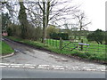
Road Junction
The junction of Parsonage Lane and The Street Chelsworth, Suffolk.
Image: © Keith Evans
Taken: 27 Feb 2011
0.05 miles
3
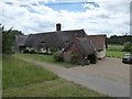
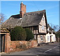
Thatched cottage in Parsonage Lane
Taken on Chelsworth Open Gardens Day 2017
Image: © Chris Holifield
Taken: 25 Jun 2017
0.08 miles
4
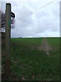
Over The Hill
Footpath sign and marked footpath leading to Bildeston church as seen from its start at Chelsworth, Suffolk.
Image: © Keith Evans
Taken: 27 Feb 2011
0.11 miles
5
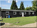
The Victory Hall at Chelsworth
The Victory Hall is appropriately a World War One Army barracks hut. It commemorated the WW1 victory and the loss of only one man, Charles PECK, in the conflict.
Image: © Adrian S Pye
Taken: 25 Aug 2015
0.12 miles
7
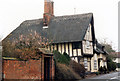
The Old Forge, 10 and 12 The Street
Grade II* Listed Late 15th, early 16th century timber-framed house originally standing at right angles to the road. The single storey wing with dormers being added later. The 1870 survey of the village shows the Old Forge as occupied by 29 year old Sherman Raynham a bricklayer (who became a key resident of the village and parish clerk for a number of years) with his wife and child and 65 year old Daniel Claydon a blacksmith and his wife who 'lived beside his smithy, replacement for an earlier forge which stood across the road in Shop Meadow'.
Image: © Jo and Steve Turner
Taken: 8 Apr 1996
0.14 miles