
IMAGES TAKEN NEAR TO
Silk Mill Close, IPSWICH, IP7 5EB
Introduction
This page details the photographs taken nearby to Silk Mill Close, IP7 5EB by members of the Geograph project.
The Geograph project started in 2005 with the aim of publishing, organising and preserving representative images for every square kilometre of Great Britain, Ireland and the Isle of Man.

There are currently over 7.5m images from over14,400 individuals and you can help contribute to the project by visiting https://www.geograph.org.uk
Image Map
Images are licensed for reuse under creativecommons.org/licenses/by-sa/2.0
Notes
- Clicking on the map will re-center to the selected point.
- The higher the marker number, the further away the image location is from the centre of the postcode.
Image Listing (162 Images Found)
Images are licensed for reuse under creativecommons.org/licenses/by-sa/2.0
Image
Details
Distance
1

Salvation Army Logo
Salvation Army logo on their building Hadleigh, Suffolk for view of the building see http://www.geograph.org.uk/photo/1438563
Image: © Keith Evans
Taken: 9 Aug 2009
0.03 miles
2
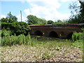
Toppesfield Bridge
A medieval three span bridge over the river Brett. It probably dates from the 14th century. It is built with stone blocks with pointed arches with spans of 3 m. (10 ft.). In 1750 the stone arches were extended with brick-work on the upstream side. http://www.transporttrust.com/heritage-sites/heritage-detail/toppesfield-bridge-hadleigh
Image: © Chris Holifield
Taken: 18 Jun 2017
0.05 miles
3
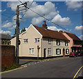
Duke Street, Hadleigh
Looking past the junction with Market Place or a link to it.
Image: © Andrew Hill
Taken: 11 Aug 2009
0.05 miles
5
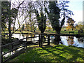
Side weir on River Brett
This overflows to a backwater that rejoins the river below the main weir and sluices at Toppesfield Mill (as was).
Image: © Robin Webster
Taken: 19 Nov 2017
0.06 miles
6
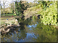
River Brett, Hadleigh
Looking upstream from Toppesfield Bridge.
Image: © Robin Webster
Taken: 19 Nov 2017
0.06 miles
7
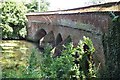
Duke St Bridge
Bridge over the River Brett at Hadleigh, Suffolk.
Image: © Peter Pearson
Taken: 30 Jul 2014
0.06 miles
8
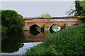
Toppesfield Bridge, Hadleigh (Suffolk)
This medieval bridge crosses the River Brett at the far end of Duke Street. The Brett is a tributary of the Stour and its source is north of Lavenham.
Image: © David Kemp
Taken: 11 May 2019
0.06 miles
9
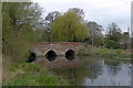
Toppesfield Bridge, Hadleigh
The bridge over the River Brett is over 500 years old.
Image: © Joan Vaughan
Taken: 26 Apr 2006
0.06 miles
10
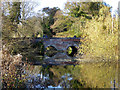
Toppesfield Bridge, Hadleigh
Over the River Brett, a grade II*(star) listed building, and also a scheduled Ancient Monument. Said to be 14th century, there are three arches, only two were easily visible on the sunny side.
Image: © Robin Webster
Taken: 19 Nov 2017
0.06 miles