
IMAGES TAKEN NEAR TO
Mulberry Gardens, IPSWICH, IP6 0HU
Introduction
This page details the photographs taken nearby to Mulberry Gardens, IP6 0HU by members of the Geograph project.
The Geograph project started in 2005 with the aim of publishing, organising and preserving representative images for every square kilometre of Great Britain, Ireland and the Isle of Man.

There are currently over 7.5m images from over14,400 individuals and you can help contribute to the project by visiting https://www.geograph.org.uk
Image Map
Images are licensed for reuse under creativecommons.org/licenses/by-sa/2.0
Notes
- Clicking on the map will re-center to the selected point.
- The higher the marker number, the further away the image location is from the centre of the postcode.
Image Listing (78 Images Found)
Images are licensed for reuse under creativecommons.org/licenses/by-sa/2.0
Image
Details
Distance
1
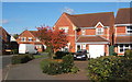
Part of modern housing estate, Great Blakenham
Image: © Andrew Hill
Taken: 30 Oct 2007
0.04 miles
2
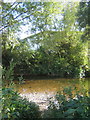
River Gipping
The river and lake have the A14 hard by to the east and a large trading / industrial estate to the west. It is remarkable that they remain generally out of sight, although the traffic noise is ever present.
Image: © Andrew Hill
Taken: 10 Sep 2007
0.15 miles
4
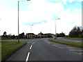
Gipping Road, Great Blakenham
At the junction with the B1113 Bramford Road
Image: © Geographer
Taken: 30 Apr 2016
0.15 miles
5
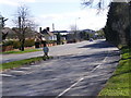
Gipping Road, Great Blakenham
Looking towards Claydon
Image: © Geographer
Taken: 8 Apr 2009
0.15 miles
6
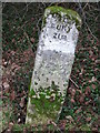
To Bury 21
Old milepost at Great Blakenham, Suffolk on what was the old A.45. For overall view see http://www.geograph.org.uk/photo/1168492 For more info see http://milestones.megalithia.com/sites/tm120505.htm do look at their home page.
Image: © Keith Evans
Taken: 18 Feb 2009
0.16 miles
7

Great Blakenham village sign
The village is not afraid to include the huge energy recovery centre which generates 20 Megawatts of Electricity from the counties domestic waste. Aldo featured is of course the church, the River Gipping and the bridge which spans it. Finally the Baptist chapel, not forgetting the chickens.
Image: © Adrian S Pye
Taken: 24 Oct 2020
0.16 miles
8
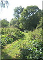
Footpath near Claydon
This path is actually very close to the River Gipping on the left and a lake to the right.
Image: © Andrew Hill
Taken: 10 Sep 2007
0.16 miles
10
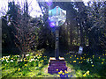
Great Blakenham Village Sign
On the B1113 Stowmarket Road
Image: © Geographer
Taken: 8 Apr 2009
0.17 miles