IMAGES TAKEN NEAR TO
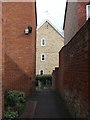
Nevilles Close, Victoria Street, BURY ST. EDMUNDS, IP33 3DD
Introduction
This page details the photographs taken nearby to Nevilles Close, Victoria Street, IP33 3DD by members of the Geograph project.
The Geograph project started in 2005 with the aim of publishing, organising and preserving representative images for every square kilometre of Great Britain, Ireland and the Isle of Man.

There are currently over 7.5m images from over14,400 individuals and you can help contribute to the project by visiting https://www.geograph.org.uk
Image Map
Images are licensed for reuse under creativecommons.org/licenses/by-sa/2.0
Notes
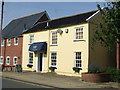
- Clicking on the map will re-center to the selected point.
- The higher the marker number, the further away the image location is from the centre of the postcode.
Image Listing (217 Images Found)
Images are licensed for reuse under creativecommons.org/licenses/by-sa/2.0
Image
Details
Distance
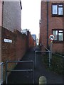
1
St. James Lane
Looking east along St.James Lane that runs between Chalk road north and Victoria road Bury St.Edmunds Suffolk.
Image: © Keith Evans
Taken: 9 Mar 2008
0.05 miles
2
Doctors Surgery
Victoria road doctors surgery Bury St.Edmunds Suffolk.
Image: © Keith Evans
Taken: 3 Dec 2006
0.05 miles
3
St. James lane
Looking west along St.James lane that runs between Chalk road north and Victoria road Bury St.Edmunds Suffolk.
Image: © Keith Evans
Taken: 23 Dec 2007
0.06 miles
4
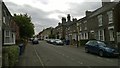
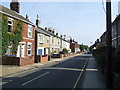
Victoria Street, Bury St Edmunds
Victorian housing just outside the old town.
Image: © Christopher Hilton
Taken: 10 Aug 2015
0.06 miles
5
Kings Road
Looking east along Kings Road Bury St.Edmunds, Suffolk
Image: © Keith Evans
Taken: 20 Sep 2008
0.06 miles
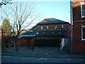
6
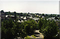
View west from multi-storey car park
Taken during a Bury St. Edmunds Car Show about 1990, the foreground shows the now redundant surface car park entrance from Chalk Road. Behind that the rooftops of Victoria Street, York Road and Risbygate Street.
Image: © John Goldsmith
Taken: Unknown
0.06 miles
7
Albion Villas
Albion Villas 1897 Albert Crescent Bury St.Edmunds Suffolk.
Image: © Keith Evans
Taken: 30 Dec 2008
0.07 miles
8
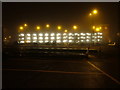
Multi-storey car park on a misty night
Off Parkway dual carriageway, with the former cattle market car park in the foreground.
Image: © John Goldsmith
Taken: 28 Jan 2009
0.07 miles
9
Mane Attraction
Former pub now a hairdressers called Mane Attraction Kings Road Bury St. Edmunds, Suffolk. The pub was called The Wheatsheaf it began its life as a beerhouse in the late 1850's and closed its doors in 1981.
Image: © Keith Evans
Taken: 20 Sep 2008
0.07 miles
10
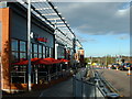
The Parkway Bury St.Edmunds
Looking north along the parkway Bury St.Edmunds Suffolk with the new development on the left.
Image: © Keith Evans
Taken: 26 Nov 2006
0.07 miles