
IMAGES TAKEN NEAR TO
St. Nicholas Way, BURY ST. EDMUNDS, IP33 2RF
Introduction
This page details the photographs taken nearby to St. Nicholas Way, IP33 2RF by members of the Geograph project.
The Geograph project started in 2005 with the aim of publishing, organising and preserving representative images for every square kilometre of Great Britain, Ireland and the Isle of Man.

There are currently over 7.5m images from over14,400 individuals and you can help contribute to the project by visiting https://www.geograph.org.uk
Image Map
Images are licensed for reuse under creativecommons.org/licenses/by-sa/2.0
Notes
- Clicking on the map will re-center to the selected point.
- The higher the marker number, the further away the image location is from the centre of the postcode.
Image Listing (38 Images Found)
Images are licensed for reuse under creativecommons.org/licenses/by-sa/2.0
Image
Details
Distance
1
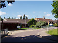
West Suffolk Hospital Bury St Edmunds
The "Wedgwood Unit" is at the rear of the hospital. It is actually part of a different NHS Trust - Suffolk Mental Health Partnership.
Image: © Andy Parrett
Taken: 23 May 2009
0.04 miles
2
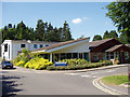
West Suffolk Hospital Bury St Edmunds
The Martin Corke Day Surgery Unit, seen in this picture, with the larger extension in white behind, is located at the rear of the main hospital building.
Image: © Andy Parrett
Taken: 23 May 2009
0.08 miles
3
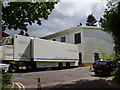
West Suffolk Hospital Bury St Edmunds
Every Tuesday (during 2009 at any rate) this articulated "Mobile Cardiac Catheterisation Unit" manoeuvrers itself into the small carpark at the rear of the Martin Corke Day Surgery Unit for the day.
Image: © Andy Parrett
Taken: 19 May 2009
0.08 miles
4
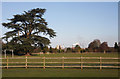
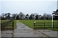
Playing fields on Hardwick Heath
Viewed from St Edmunds Way, across Hardwick Heath. Visible in the distance are the tower of St Edmundsbury Cathedral, the sugar beet factory, and the tall chimneys of the Greene King brewery in Bury St Edmunds.
Image: © Bob Jones
Taken: 26 Dec 2009
0.10 miles
7
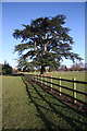
Hardwick Heath and St Edmunds Way
The long-distance footpath, St Edmunds Way, runs alongside the West Suffolk Hospital on the western edge of Hardwick Heath.
Image: © Bob Jones
Taken: 26 Dec 2009
0.12 miles

10
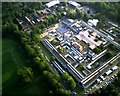
West Suffolk hospital from the air
The hospital moved to this new site in the early 1970s but already there is talk that it needs more space and there are plans to start again on a new site to the west of Bury St. Edmunds.
The photo was taken using a Flycam One2 camera on an electric model aircraft.
Image: © John Goldsmith
Taken: 12 Jun 2010
0.13 miles