
IMAGES TAKEN NEAR TO
Ipswich Street, BURY ST. EDMUNDS, IP33 1SX
Introduction
This page details the photographs taken nearby to Ipswich Street, IP33 1SX by members of the Geograph project.
The Geograph project started in 2005 with the aim of publishing, organising and preserving representative images for every square kilometre of Great Britain, Ireland and the Isle of Man.

There are currently over 7.5m images from over14,400 individuals and you can help contribute to the project by visiting https://www.geograph.org.uk
Image Map
Images are licensed for reuse under creativecommons.org/licenses/by-sa/2.0
Notes
- Clicking on the map will re-center to the selected point.
- The higher the marker number, the further away the image location is from the centre of the postcode.
Image Listing (444 Images Found)
Images are licensed for reuse under creativecommons.org/licenses/by-sa/2.0
Image
Details
Distance
3
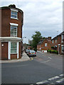
Lower part of St. John's Street
St. John's, named after its tall church, comes from the right in this scene, and heads down to a dead end. Ipswich Street to the left leads to Station Hill. The building on the left corner has a wedge shape with a rounded corner. It is visible in pictures taken from the church spire in the 1890s.
Image: © John Goldsmith
Taken: 1 Aug 2010
0.02 miles
4
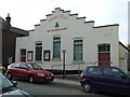
Salvation Army citadel
Salvation Army citadel St.Johns street Bury St.Edmunds Suffolk.
Image: © Keith Evans
Taken: 4 Nov 2007
0.02 miles
5
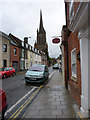
St John Street, Bury St Edmunds, Suffolk
Looking towards the church of St John the Evangelist.
Image: © Christine Matthews
Taken: 8 May 2010
0.02 miles
8
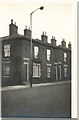
Ipswich Terrace
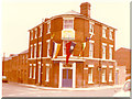
To the left Ipswich Terrace, the whole block razed to the ground mid June 1974.
Image: © Jorn Cooper
Taken: Unknown
0.03 miles
10
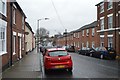
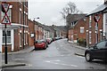
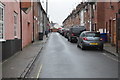
Peckham Street
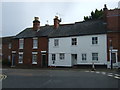
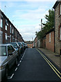
A Victorian era terrace with a major parking problem. Some classic Suffolk flint construction on the right (south). Visible on the left are two remaining Ionica radio based telephone system dishes, small and octagonal. This company died years ago but left the worthless dishes. There is a close-up view at Image
As in most places in 'sugartown' a part of the sugar factory is visible, on the left horizon, above Ipswich Street.
I have spoken to a Mr Peckham who told me his ancestors ran a ropeworks on this site, which was on the edge of town in Victorian times, but at some point they decided to build terraced housing, cashing in on the local building boom and expansion towards the station.
Image: © John Goldsmith
Taken: 2 Sep 2008
0.03 miles