
IMAGES TAKEN NEAR TO
Abbeygate Street, BURY ST. EDMUNDS, IP33 1LQ
Introduction
This page details the photographs taken nearby to Abbeygate Street, IP33 1LQ by members of the Geograph project.
The Geograph project started in 2005 with the aim of publishing, organising and preserving representative images for every square kilometre of Great Britain, Ireland and the Isle of Man.

There are currently over 7.5m images from over14,400 individuals and you can help contribute to the project by visiting https://www.geograph.org.uk
Image Map
Images are licensed for reuse under creativecommons.org/licenses/by-sa/2.0
Notes
- Clicking on the map will re-center to the selected point.
- The higher the marker number, the further away the image location is from the centre of the postcode.
Image Listing (1892 Images Found)
Images are licensed for reuse under creativecommons.org/licenses/by-sa/2.0
Image
Details
Distance
1
![Bury St Edmunds buildings [34]](https://s2.geograph.org.uk/geophotos/06/64/73/6647338_f97268d7_120x120.jpg)
Bury St Edmunds buildings [34]
Number 57 Abbeygate Street includes numbers 90, 91 and 92 Whiting Street. Originally house and shop, now offices. 18th century, timber framed and stuccoed, incorporating a 17th century structure. Much restored in 1969 including the shop front. Listed, grade II, with details at: https://historicengland.org.uk/listing/the-list/list-entry/1141144
Abbeygate Street is the principal shopping street of the town.
Bury St Edmunds is a market town which is the cultural and retail centre for West Suffolk and is known for brewing (Greene King) and sugar (British Sugar). There is scattered evidence of earlier activity but essentially Bury St Edmunds began as one of the royal boroughs of the Saxons and a monastery was founded which became the burial place of King Edmund. A new Benedictine abbey was built in 1020 which became rich and powerful and the town was laid out on a grid pattern by Abbot Baldwin. After the dissolution the abbey became ruinous. A new church, later the cathedral, was begun in the early 16th century.
Image: © Michael Dibb
Taken: 13 Sep 2020
0.01 miles

3
![Bury St Edmunds buildings [142]](https://s2.geograph.org.uk/geophotos/06/67/31/6673198_51c93122_120x120.jpg)
Bury St Edmunds buildings [142]
Built as a house in the 17th century, number 89 Whiting Street was later a shop with accommodation above and is now used as offices. Timber framed and stuccoed, the building was refronted in brick and the two shop windows inserted in the early 19th century. Listed, grade II, with details at: https://historicengland.org.uk/listing/the-list/list-entry/1132609
Whiting Street is one of the north-south streets laid out by Abbot Baldwin in the 12th century and has buildings from the early medieval to the late 20th century. The street is divided by Churchgate Street at its midpoint and the character is mainly residential to the southern part with a mixture of residential with retail and commercial uses to the northern part.
Bury St Edmunds is a market town which is the cultural and retail centre for West Suffolk and is known for brewing (Greene King) and sugar (British Sugar). There is scattered evidence of earlier activity but essentially Bury St Edmunds began as one of the royal boroughs of the Saxons and a monastery was founded which became the burial place of King Edmund. A new Benedictine abbey was built in 1020 which became rich and powerful and the town was laid out on a grid pattern by Abbot Baldwin. After the dissolution the abbey became ruinous. A new church, later the cathedral, was begun in the early 16th century.
Image: © Michael Dibb
Taken: 13 Sep 2020
0.01 miles
4
![Bury St Edmunds buildings [33]](https://s0.geograph.org.uk/geophotos/06/64/59/6645960_48b3e887_120x120.jpg)
Bury St Edmunds buildings [33]
Number 56 Abbeygate Street incorporates numbers 1 and 2A Whiting Street. Timber framed and stuccoed, built in 4 stages, the oldest part being the four late 15th century southernmost bays in Whiting Street. These 4 bays formed a single-ended Wealden house with a 2-bay open hall a wide cross entry and a jettied service bay. Additions were made in the 16th and 17th centuries and the building was refronted in the 19th century. There are extensive cellars which are medieval below the Whiting Street range. Listed, grade II*, with details at; https://historicengland.org.uk/listing/the-list/list-entry/1141143
Abbeygate Street is the principal shopping street of the town.
Bury St Edmunds is a market town which is the cultural and retail centre for West Suffolk and is known for brewing (Greene King) and sugar (British Sugar). There is scattered evidence of earlier activity but essentially Bury St Edmunds began as one of the royal boroughs of the Saxons and a monastery was founded which became the burial place of King Edmund. A new Benedictine abbey was built in 1020 which became rich and powerful and the town was laid out on a grid pattern by Abbot Baldwin. After the dissolution the abbey became ruinous. A new church, later the cathedral, was begun in the early 16th century.
Image: © Michael Dibb
Taken: 13 Sep 2020
0.01 miles
5

Abbeygate Street
Grade II listed. https://www.britishlistedbuildings.co.uk/101141147-59-abbeygate-street-bury-st-edmunds
Image: © N Chadwick
Taken: 10 Feb 2018
0.01 miles
6
![Bury St Edmunds buildings [35]](https://s3.geograph.org.uk/geophotos/06/64/73/6647339_e74f8b6e_120x120.jpg)
Bury St Edmunds buildings [35]
Now home to a firm of opticians, number 58 Abbeygate Street was formerly a house and shop. Built in the 16th and 17th centuries, timber framed and stuccoed, with the frontage restored and a new shop front inserted in the late 20th century. The rear range, originally jetties was underbuilt in the 19th century. There is some carving on a corner post which may illustrate part of the legend of Hercules. The rear range has timbers exposed and extensively decorated in both the ground-storey and 1st storey rooms. Listed, grade II*, with details at: https://historicengland.org.uk/listing/the-list/list-entry/1141145
Abbeygate Street is the principal shopping street of the town.
Bury St Edmunds is a market town which is the cultural and retail centre for West Suffolk and is known for brewing (Greene King) and sugar (British Sugar). There is scattered evidence of earlier activity but essentially Bury St Edmunds began as one of the royal boroughs of the Saxons and a monastery was founded which became the burial place of King Edmund. A new Benedictine abbey was built in 1020 which became rich and powerful and the town was laid out on a grid pattern by Abbot Baldwin. After the dissolution the abbey became ruinous. A new church, later the cathedral, was begun in the early 16th century.
Image: © Michael Dibb
Taken: 14 Sep 2020
0.01 miles
7

59 Abbeygate Street
Grade II listed former Alliance Insurance Company offices by J.S.Corder of Ipswich 1891. Now Damson & Wilde bar & restaurant
Image: © Richard Croft
Taken: 11 Sep 2023
0.01 miles
8
![Bury St Edmunds buildings [1]](https://s0.geograph.org.uk/geophotos/06/64/33/6643364_2cd47c73_120x120.jpg)
Bury St Edmunds buildings [1]
Number 1 Abbeygate Street, now offices, was built as a shop with living accommodation above in the late 15th century. The building with the first floor jettied on three sides, timber framed and stuccoed, was extended in the early 16th century and restored in 1988 when the existing shop fronts were inserted. Many original early and later features remain. Listed, grade II, with details at: https://historicengland.org.uk/listing/the-list/list-entry/1021953
Abbeygate Street is the principal shopping street of the town.
Bury St Edmunds is a market town which is the cultural and retail centre for West Suffolk and is known for brewing (Greene King) and sugar (British Sugar). There is scattered evidence of earlier activity but essentially Bury St Edmunds began as one of the royal boroughs of the Saxons and a monastery was founded which became the burial place of King Edmund. A new Benedictine abbey was built in 1020 which became rich and powerful and the town was laid out on a grid pattern by Abbot Baldwin. After the dissolution the abbey became ruinous. A new church, later the cathedral, was begun in the early 16th century.
Image: © Michael Dibb
Taken: 14 Sep 2020
0.01 miles
9
![Bury St Edmunds buildings [129]](https://s3.geograph.org.uk/geophotos/06/66/93/6669347_7c070ee2_120x120.jpg)
Bury St Edmunds buildings [129]
Numbers 4 and 5 Whiting Street were originally one house now irregularly divided into two with number 4 occupying only a part of the ground floor. Built in the 16th century, timber framed, jettied along the street and roughcast. There is an overlap with number 6 with a 2nd entrance door below an extension to the jetty. There are two, probably 19th century, rear wings. Listed, grade II, with details at: https://historicengland.org.uk/listing/the-list/list-entry/1142293
Whiting Street is one of the north-south streets laid out by Abbot Baldwin in the 12th century and has buildings from the early medieval to the late 20th century. The street is divided by Churchgate Street at its midpoint and the character is mainly residential to the southern part with a mixture of residential with retail and commercial uses to the northern part.
Bury St Edmunds is a market town which is the cultural and retail centre for West Suffolk and is known for brewing (Greene King) and sugar (British Sugar). There is scattered evidence of earlier activity but essentially Bury St Edmunds began as one of the royal boroughs of the Saxons and a monastery was founded which became the burial place of King Edmund. A new Benedictine abbey was built in 1020 which became rich and powerful and the town was laid out on a grid pattern by Abbot Baldwin. After the dissolution the abbey became ruinous. A new church, later the cathedral, was begun in the early 16th century.
Image: © Michael Dibb
Taken: 13 Sep 2020
0.01 miles
10
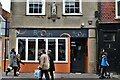
Bury St Edmunds: Boosh Bar, 2 Abbeygate Street
Image: © Michael Garlick
Taken: 4 Feb 2023
0.01 miles