
IMAGES TAKEN NEAR TO
Central Walk, BURY ST. EDMUNDS, IP33 1BS
Introduction
This page details the photographs taken nearby to Central Walk, IP33 1BS by members of the Geograph project.
The Geograph project started in 2005 with the aim of publishing, organising and preserving representative images for every square kilometre of Great Britain, Ireland and the Isle of Man.

There are currently over 7.5m images from over14,400 individuals and you can help contribute to the project by visiting https://www.geograph.org.uk
Image Map
Images are licensed for reuse under creativecommons.org/licenses/by-sa/2.0
Notes
- Clicking on the map will re-center to the selected point.
- The higher the marker number, the further away the image location is from the centre of the postcode.
Image Listing (1133 Images Found)
Images are licensed for reuse under creativecommons.org/licenses/by-sa/2.0
Image
Details
Distance
2
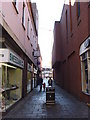
Walkway between Cornhill and St. Andrew's Street South
Image: © Oxyman
Taken: 24 Mar 2008
0.01 miles
4
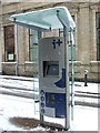
Information point
Information point Cornhill Bury St.Edmunds Suffolk.
Image: © Keith Evans
Taken: 23 Mar 2008
0.02 miles
5
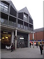
Jessops Closed
Jessops shop closed and now in administration. This shop was only opened late 2012 after it moved to this location after being forced from its old site because of a major fire next door on the night of the 16 June 2012 see http://www.geograph.org.uk/photo/2997169 for aftermath of the fire. For view of the old shop see http://www.geograph.org.uk/photo/3293835. See http://www.geograph.org.uk/photo/3293846 for administrators notice.
Image: © Keith Evans
Taken: 13 Jan 2013
0.02 miles
6
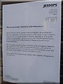
Administrators' Notice
Administrators' notice on the doors of Jessops in The Arc shopping centre Bury St. Edmunds, Suffolk. For view of the shop see http://www.geograph.org.uk/photo/3293842
Image: © Keith Evans
Taken: 13 Jan 2013
0.02 miles
8
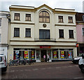
Shop frontage
Iceland store on Cornhill, Bury St Edmunds.
Image: © Andrew Hill
Taken: 7 May 2009
0.03 miles
9
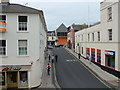
Woolhall Street from Corn Exchange
In the 1960s the Corn Exchange building was preserved by inserting a mezzanine floor for a public meeting and performance space upstairs, and shops below. This view from a window shows Woolhall Street, probably Bury's shortest, ending at the sharp roofed battleship grey of part of the arc development. Caaroline's dress shop has closed since this photo, having lasted only a few months. The BetFred premises used to be the Job Centre.
Image: © John Goldsmith
Taken: 9 Sep 2009
0.03 miles
10
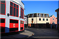
Night club corner, Bury St Edmunds
As a town hardly renowned for its night clubs, Bury St Edmunds now has two opposite each other - and in the centre of town. The red building is 'Deja Vu' (without the accents). The building on the other side of the road is known as 'Ruin'. These two buildings are located at the junction of Kings Road, Woolhall Street and St Andrew's Street South.
Image: © Bob Jones
Taken: 3 Feb 2009
0.03 miles