
IMAGES TAKEN NEAR TO
St. Edmunds Mews, Abbeyfields, BURY ST. EDMUNDS, IP33 1AT
Introduction
This page details the photographs taken nearby to St. Edmunds Mews, Abbeyfields, IP33 1AT by members of the Geograph project.
The Geograph project started in 2005 with the aim of publishing, organising and preserving representative images for every square kilometre of Great Britain, Ireland and the Isle of Man.

There are currently over 7.5m images from over14,400 individuals and you can help contribute to the project by visiting https://www.geograph.org.uk
Image Map
Images are licensed for reuse under creativecommons.org/licenses/by-sa/2.0
Notes
- Clicking on the map will re-center to the selected point.
- The higher the marker number, the further away the image location is from the centre of the postcode.
Image Listing (103 Images Found)
Images are licensed for reuse under creativecommons.org/licenses/by-sa/2.0
Image
Details
Distance
1
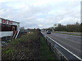
A.14 looking west
Looking west along the A14 from near Bury Bowl just off Eastgate Street Bury St. Edmunds Suffolk.
Image: © Keith Evans
Taken: 9 Mar 2008
0.04 miles
2
![Bury St Edmunds houses [292]](https://s0.geograph.org.uk/geophotos/06/69/57/6695784_c4105f36_120x120.jpg)
Bury St Edmunds houses [292]
Numbers 37, 38 and 39 Eastgate Street were originally one house, now divided into three. Built in the early 18th century, timber framed and refronted in red brick with bands of white brick in the 19th century when the house was divided. Listed, grade II, with details at: https://historicengland.org.uk/listing/the-list/list-entry/1343596
Until the second half of the 20th century, there were almost no buildings east of the River Lark except along Eastgate Street which has a number of 16th and 17th century houses. Now there are several large housing estates and a fairly large industrial estate.
Bury St Edmunds is a market town which is the cultural and retail centre for West Suffolk and is known for brewing (Greene King) and sugar (British Sugar). There is scattered evidence of earlier activity but essentially Bury St Edmunds began as one of the royal boroughs of the Saxons and a monastery was founded which became the burial place of King Edmund. A new Benedictine abbey was built in 1020 which became rich and powerful and the town was laid out on a grid pattern by Abbot Baldwin. After the dissolution the abbey became ruinous. A new church, later the cathedral, was begun in the early 16th century.
Image: © Michael Dibb
Taken: 8 Sep 2020
0.07 miles
3
![Bury St Edmunds houses [293]](https://s3.geograph.org.uk/geophotos/06/69/59/6695991_b22a77a3_120x120.jpg)
Bury St Edmunds houses [293]
Number 43 Eastgate Street is the surviving two bays of a larger house. Built in the late 15th or early 16th century, refronted in red brick in the mid 19th century. There are some remnants of the original wattle and daub infill. Listed, grade II, with details at: https://historicengland.org.uk/listing/the-list/list-entry/1343597
Until the second half of the 20th century, there were almost no buildings east of the River Lark except along Eastgate Street which has a number of 16th and 17th century houses. Now there are several large housing estates and a fairly large industrial estate.
Bury St Edmunds is a market town which is the cultural and retail centre for West Suffolk and is known for brewing (Greene King) and sugar (British Sugar). There is scattered evidence of earlier activity but essentially Bury St Edmunds began as one of the royal boroughs of the Saxons and a monastery was founded which became the burial place of King Edmund. A new Benedictine abbey was built in 1020 which became rich and powerful and the town was laid out on a grid pattern by Abbot Baldwin. After the dissolution the abbey became ruinous. A new church, later the cathedral, was begun in the early 16th century.
Image: © Michael Dibb
Taken: 8 Sep 2020
0.07 miles
4
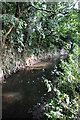
River Lark, Bury St Edmunds
Looking upstream from near the football stadium.
Image: © Bob Jones
Taken: 19 Aug 2008
0.08 miles
5
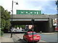
A14 bridge over Eastgate Street, Bury St Edmunds
Image: © JThomas
Taken: 14 Sep 2015
0.08 miles
6
![Bury St Edmunds features [38]](https://s0.geograph.org.uk/geophotos/06/69/57/6695760_2e7ec91b_120x120.jpg)
Bury St Edmunds features [38]
This ugly, functional bridge carries the A14 by-pass over Eastgate Street. The by-pass follows the line of the dismantled railway line that ran from Bury St Edmunds to Sudbury via Lavenham.
Until the second half of the 20th century, there were almost no buildings east of the River Lark except along Eastgate Street which has a number of 16th and 17th century houses. Now there are several large housing estates and a fairly large industrial estate.
Bury St Edmunds is a market town which is the cultural and retail centre for West Suffolk and is known for brewing (Greene King) and sugar (British Sugar). There is scattered evidence of earlier activity but essentially Bury St Edmunds began as one of the royal boroughs of the Saxons and a monastery was founded which became the burial place of King Edmund. A new Benedictine abbey was built in 1020 which became rich and powerful and the town was laid out on a grid pattern by Abbot Baldwin. After the dissolution the abbey became ruinous. A new church, later the cathedral, was begun in the early 16th century.
Image: © Michael Dibb
Taken: 8 Sep 2020
0.08 miles
7
![Bury St Edmunds houses [297]](https://s0.geograph.org.uk/geophotos/06/69/66/6696608_44b5d2e2_120x120.jpg)
Bury St Edmunds houses [297]
This row of three houses, numbers 93, 94 and 95 Eastgate Street was built in the later 17th century, refronted in the 19th century. Numbers 94 and 95 were originally one house, now two. Listed, grade II, with details at: https://historicengland.org.uk/listing/the-list/list-entry/1343601
Until the second half of the 20th century, there were almost no buildings east of the River Lark except along Eastgate Street which has a number of 16th and 17th century houses. Now there are several large housing estates and a fairly large industrial estate.
Bury St Edmunds is a market town which is the cultural and retail centre for West Suffolk and is known for brewing (Greene King) and sugar (British Sugar). There is scattered evidence of earlier activity but essentially Bury St Edmunds began as one of the royal boroughs of the Saxons and a monastery was founded which became the burial place of King Edmund. A new Benedictine abbey was built in 1020 which became rich and powerful and the town was laid out on a grid pattern by Abbot Baldwin. After the dissolution the abbey became ruinous. A new church, later the cathedral, was begun in the early 16th century.
Image: © Michael Dibb
Taken: 8 Sep 2020
0.08 miles
8
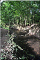
River Lark, Bury St Edmunds
Looking downstream from near the football stadium.
Image: © Bob Jones
Taken: 19 Aug 2008
0.08 miles
9
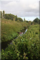
River Lark, Bury St Edmunds
Once navigable, the river is little more than a stream, with nettles and other weeds threatening to choke the waterway. The A14 follows the line of trees on the embankment to the left.
Image: © Bob Jones
Taken: 19 Aug 2008
0.09 miles
10
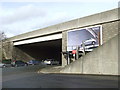
Flyover
Flyover that takes the A14 over Eastgate Street Bury St. Edmunds, Suffolk.
Image: © Keith Evans
Taken: 9 Mar 2008
0.09 miles