Bury St Edmunds houses [293]
Introduction
The photograph on this page of Bury St Edmunds houses [293] by Michael Dibb as part of the Geograph project.
The Geograph project started in 2005 with the aim of publishing, organising and preserving representative images for every square kilometre of Great Britain, Ireland and the Isle of Man.

There are currently over 7.5m images from over 14,400 individuals and you can help contribute to the project by visiting https://www.geograph.org.uk
Bury St Edmunds houses [293]
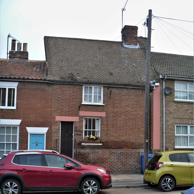
Image: © Michael Dibb Taken: 8 Sep 2020
Number 43 Eastgate Street is the surviving two bays of a larger house. Built in the late 15th or early 16th century, refronted in red brick in the mid 19th century. There are some remnants of the original wattle and daub infill. Listed, grade II, with details at: https://historicengland.org.uk/listing/the-list/list-entry/1343597 Until the second half of the 20th century, there were almost no buildings east of the River Lark except along Eastgate Street which has a number of 16th and 17th century houses. Now there are several large housing estates and a fairly large industrial estate. Bury St Edmunds is a market town which is the cultural and retail centre for West Suffolk and is known for brewing (Greene King) and sugar (British Sugar). There is scattered evidence of earlier activity but essentially Bury St Edmunds began as one of the royal boroughs of the Saxons and a monastery was founded which became the burial place of King Edmund. A new Benedictine abbey was built in 1020 which became rich and powerful and the town was laid out on a grid pattern by Abbot Baldwin. After the dissolution the abbey became ruinous. A new church, later the cathedral, was begun in the early 16th century.
Images are licensed for reuse under creativecommons.org/licenses/by-sa/2.0
Image Location
Latitude
52.24837
Longitude
0.724845