
IMAGES TAKEN NEAR TO
Qwysson Avenue, BURY ST. EDMUNDS, IP33 1AH
Introduction
This page details the photographs taken nearby to Qwysson Avenue, IP33 1AH by members of the Geograph project.
The Geograph project started in 2005 with the aim of publishing, organising and preserving representative images for every square kilometre of Great Britain, Ireland and the Isle of Man.

There are currently over 7.5m images from over14,400 individuals and you can help contribute to the project by visiting https://www.geograph.org.uk
Image Map
Images are licensed for reuse under creativecommons.org/licenses/by-sa/2.0
Notes
- Clicking on the map will re-center to the selected point.
- The higher the marker number, the further away the image location is from the centre of the postcode.
Image Listing (317 Images Found)
Images are licensed for reuse under creativecommons.org/licenses/by-sa/2.0
Image
Details
Distance
1
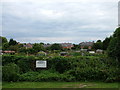
Allotments and new flats
The flats were built on a former industrial site, if you can call rearing chicks industrial. The river Lark runs alongside the allotment site and the gardening may be on the alluvial plain created long ago by the river.
Image: © John Goldsmith
Taken: 1 Aug 2010
0.04 miles
2
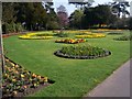
Spring Flowers - Bury St Edmunds
Beautiful spring display in the Abbey Gardens.
Image: © Colin Babb
Taken: 14 Apr 2010
0.06 miles
3
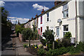
Reeds Buildings, Bury St Edmunds
This short road, off Northgate Street, is named Reeds Buildings. It consists of terraced cottages on the north side of the road.
Image: © Bob Jones
Taken: 21 May 2010
0.07 miles
4
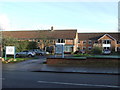
North Court
North Court nursing and residential home Northgate street Bury St.Edmunds Suffolk.
Image: © Keith Evans
Taken: 23 Dec 2007
0.07 miles

8
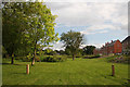
New housing, Bury St Edmunds
The houses are in Belmont Road; the low-lying recreational area in the flood plain of the River Lark has been created recently.
Image: © Bob Jones
Taken: 19 Aug 2008
0.09 miles
9
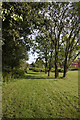
Recreational area, Bury St Edmunds
This newly-developed area is associated with new housing development at Belmont Road.
Image: © Bob Jones
Taken: 19 Aug 2008
0.09 miles
10

Bury St Edmunds Cathedral and Norman Tower
Viewed across the rooftops of Bury St Edmunds, the modern stone of the newly completed cathedral tower stands out behind the 12th century Norman Tower.
Image: © Bob Jones
Taken: 28 Oct 2005
0.10 miles