
IMAGES TAKEN NEAR TO
Hollow Road, BURY ST. EDMUNDS, IP32 7FA
Introduction
This page details the photographs taken nearby to Hollow Road, IP32 7FA by members of the Geograph project.
The Geograph project started in 2005 with the aim of publishing, organising and preserving representative images for every square kilometre of Great Britain, Ireland and the Isle of Man.

There are currently over 7.5m images from over14,400 individuals and you can help contribute to the project by visiting https://www.geograph.org.uk
Image Map
Images are licensed for reuse under creativecommons.org/licenses/by-sa/2.0
Notes
- Clicking on the map will re-center to the selected point.
- The higher the marker number, the further away the image location is from the centre of the postcode.
Image Listing (11 Images Found)
Images are licensed for reuse under creativecommons.org/licenses/by-sa/2.0
Image
Details
Distance
1
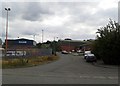
Mercers Road, Bury St Edmunds
An area of light industrial and wholesale units.
Image: © Stuart Shepherd
Taken: 19 Aug 2015
0.11 miles
2
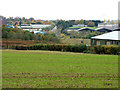
View across Hollow Road Farm to sugar factory area
Hollow Road heads straight up the middle of the shot, with an industrial estate on the left (East). To the right the Social Club for the sugar factory can be seen overlooking its sports field. The neat bank in the middle ground retains water in a pond, probably for the factory rather than the farm. A road is hidden in the bottom of the valley.
Image: © John Goldsmith
Taken: 26 Oct 2009
0.14 miles
4

Sugar factory in the sun
A small part of the Bury St. Edmunds sugar factory is displayed at its best with a bright sun and blue sky. The wind is in the prevailing direction, spreading the distinctive smell over the villages to the East.
That's not smoke by the way - it is a cloud of condensing water vapour.
Image: © John Goldsmith
Taken: 15 Nov 2009
0.18 miles
5

Sugar Beet Factory
Viewed from the bridleway near Westfield Farm.
Image: © Bob Jones
Taken: 2 Oct 2008
0.19 miles
6

Sugar beet factory, Bury St Edmunds
British Sugar's manufacturing and packaging plant on the eastern outskirts of the town.
Image: © Bob Jones
Taken: 28 Jun 2005
0.21 miles
8
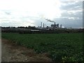
Sugar Factory
Sugar beet factory Bury St.Edmunds as seen from near Westfield Farm.
Image: © Keith Evans
Taken: 30 Sep 2009
0.23 miles
9
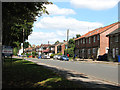
Houses in Hollow Road, Bury St Edmunds
Image: © Evelyn Simak
Taken: 31 Aug 2010
0.24 miles
10
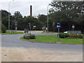
Roundabout at Hollow Road
This roundabout is one of several entrances to the British Sugar factory.
Image: © Helen Steed
Taken: 6 Aug 2011
0.24 miles