
IMAGES TAKEN NEAR TO
Klondyke, BURY ST. EDMUNDS, IP32 6DB
Introduction
This page details the photographs taken nearby to Klondyke, IP32 6DB by members of the Geograph project.
The Geograph project started in 2005 with the aim of publishing, organising and preserving representative images for every square kilometre of Great Britain, Ireland and the Isle of Man.

There are currently over 7.5m images from over14,400 individuals and you can help contribute to the project by visiting https://www.geograph.org.uk
Image Map
Images are licensed for reuse under creativecommons.org/licenses/by-sa/2.0
Notes
- Clicking on the map will re-center to the selected point.
- The higher the marker number, the further away the image location is from the centre of the postcode.
Image Listing (38 Images Found)
Images are licensed for reuse under creativecommons.org/licenses/by-sa/2.0
Image
Details
Distance
1
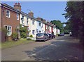
The Klondyke, western section
A gravelled road in three distinct sections: the western part, with a few old cottages; a central area comprising a footpath in a narrow strip of grass; and an eastern section with a few houses and bungalows.
Image: © Carl Grove
Taken: 5 Jul 2013
0.01 miles
2
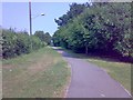
The Klondyke, central section
The grassy walkway which joins two rough-surfaced roadways
Image: © Carl Grove
Taken: 5 Jul 2013
0.10 miles
3

Lancaster Gospel Hall
This is described as a meeting place for Christians in Bury St Edmunds https://www.lancastergospelhall.org.uk/index.php/about
Image: © Richard Rogerson
Taken: 21 Jul 2026
0.10 miles
4
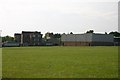
County Upper School
The rear of the school, including the sports hall, across the playing field.
Image: © Bob Jones
Taken: 22 Jun 2005
0.11 miles
6
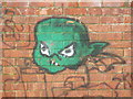
Graffiti
Graffiti Bury St. Edmunds, Suffolk.
Image: © Keith Evans
Taken: 21 Feb 2010
0.14 miles
7
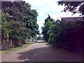
The Klondyke, eastern section
Here the roadway approaches Northgate Avenue
Image: © Carl Grove
Taken: 30 Jun 2013
0.17 miles
8
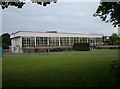
A classic 1960s factory block
This factory was built in the mid 60s for Vitality Bulbs, a manufacturer of specialist miniature light bulbs. Since then they have become VCH and now CML, with LEDs on the product list. The simple style of the building disguises its size.
The A14 road runs just behind those trees - that was not there when the factory was built, nor were the surrounding industrial estates.
Image: © John Goldsmith
Taken: 18 Jun 2010
0.18 miles
9
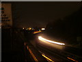
The A14 at night
The A14 Bury St. Edmunds 'by-pass' is unusual in that in runs through the town.
The bright lights in the distance are the Leisure Centre.
Image: © John Goldsmith
Taken: 10 Dec 2008
0.19 miles
10
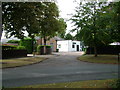
Surprising industrial estate
In the middle of a housing area we suddenly find this little industrial estate, at the corner of Northgate Avenue and Norfolk Road. The road deteriorates to a dirt track and leads through to Tollgate Lane, although pillars block cars and vans.
Image: © John Goldsmith
Taken: 6 Sep 2009
0.19 miles