IMAGES TAKEN NEAR TO
Ixworth, BURY ST. EDMUNDS, IP31 2HQ
Introduction
This page details the photographs taken nearby to IP31 2HQ by members of the Geograph project.
The Geograph project started in 2005 with the aim of publishing, organising and preserving representative images for every square kilometre of Great Britain, Ireland and the Isle of Man.

There are currently over 7.5m images from over14,400 individuals and you can help contribute to the project by visiting https://www.geograph.org.uk
Image Map
Images are licensed for reuse under creativecommons.org/licenses/by-sa/2.0
Notes
- Clicking on the map will re-center to the selected point.
- The higher the marker number, the further away the image location is from the centre of the postcode.
Image Listing (241 Images Found)
Images are licensed for reuse under creativecommons.org/licenses/by-sa/2.0
Image
Details
Distance
1
![Ixworth houses [50]](https://s0.geograph.org.uk/geophotos/06/70/97/6709720_0b47b18d_120x120.jpg)
Ixworth houses [50]
The house known as Ixworth Abbey incorporates the remains of a priory of Augustinian canons founded in 1170. The priory was dissolved in 1537. In various materials (freestone, flint, red brick, white brick, timber-framing, plaster) the house contains elements from the 13th to the 19th century. Listed, grade I, with details at: https://historicengland.org.uk/listing/the-list/list-entry/1031475
Ixworth is a village some 7 miles north east of Bury St Edmunds. Settled in Roman times and the site of a Roman fort. Later a civilian settlement was established and it became an important junction in the Roman road system of East Anglia. An Augustinian priory was founded in about 1170 and dissolved in 1537. Ixworth is the site of the earliest rural council housing built in England. Now most working residents commute to Bury St Edmunds.
Image: © Michael Dibb
Taken: 7 Sep 2020
0.01 miles
2

Former Augustinian Priory
Former Augustinian priory now a private house Ixworth, Suffolk.
Image: © Keith Evans
Taken: 6 May 2009
0.01 miles
3

Former Abbey, Ixworth
This former Augustinian priory has been converted into a splendid private house. Behind can be seen the church of St Mary the Virgin, in Ixworth.
Image: © Bob Jones
Taken: 17 Apr 2008
0.02 miles
4
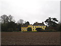
Ixworth Abbey
This Grade I listed house incorporates some parts of the former Augustinian Abbey of Ixworth. http://www.britishlistedbuildings.co.uk/en-283579-ixworth-abbey-ixworth-suffolk
Image: © Chris Holifield
Taken: 1 Jan 2014
0.02 miles
5

Ixworth Abbey
This part of the house is largely 17th century although the house contains considerable remains of the Augustinian Priory from which it developed. Listed Grade I.
The ground in front of the house, in agricultural use as recently as 2014 https://www.geograph.org.uk/photo/3798869 , has been converted to a cricket pitch.
Image: © Alan Murray-Rust
Taken: 17 Feb 2022
0.02 miles
6
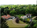
View south-west from St Mary's church tower
The church tower is not normally open to the public, and once you've climbed the steep spiral staircase the walls are so high you need a step-ladder to see over them. However the views are unique, no other building is as high or as centrally positioned in the village.
Image: © David Ayrton
Taken: 2 May 2011
0.05 miles
7
![Ixworth features [8]](https://s2.geograph.org.uk/geophotos/06/70/97/6709722_f41ae6e4_120x120.jpg)
Ixworth features [8]
The bird scarer at the edge of the cricket ground.
Ixworth is a village some 7 miles north east of Bury St Edmunds. Settled in Roman times and the site of a Roman fort. Later a civilian settlement was established and it became an important junction in the Roman road system of East Anglia. An Augustinian priory was founded in about 1170 and dissolved in 1537. Ixworth is the site of the earliest rural council housing built in England. Now most working residents commute to Bury St Edmunds.
Image: © Michael Dibb
Taken: 7 Sep 2020
0.06 miles
8
![Parish church [3]](https://s3.geograph.org.uk/geophotos/06/70/96/6709691_699ac2d7_120x120.jpg)
Parish church [3]
Part of the churchyard.
The parish church of St Mary is late 14th century with a late 15th century tower. The church was enlarged in the early 16th century and restored in the 1850s. Built in random flint with stone dressings. The church contains some fine memorials. Listed, grade I, with details at: https://historicengland.org.uk/listing/the-list/list-entry/1180826
Ixworth is a village some 7 miles north east of Bury St Edmunds. Settled in Roman times and the site of a Roman fort. Later a civilian settlement was established and it became an important junction in the Roman road system of East Anglia. An Augustinian priory was founded in about 1170 and dissolved in 1537. Ixworth is the site of the earliest rural council housing built in England. Now most working residents commute to Bury St Edmunds.
Image: © Michael Dibb
Taken: 7 Sep 2020
0.08 miles
9
![Parish church [5]](https://s3.geograph.org.uk/geophotos/06/70/96/6709695_a904ff43_120x120.jpg)
Parish church [5]
The tower arch.
The parish church of St Mary is late 14th century with a late 15th century tower. The church was enlarged in the early 16th century and restored in the 1850s. Built in random flint with stone dressings. The church contains some fine memorials. Listed, grade I, with details at: https://historicengland.org.uk/listing/the-list/list-entry/1180826
Ixworth is a village some 7 miles north east of Bury St Edmunds. Settled in Roman times and the site of a Roman fort. Later a civilian settlement was established and it became an important junction in the Roman road system of East Anglia. An Augustinian priory was founded in about 1170 and dissolved in 1537. Ixworth is the site of the earliest rural council housing built in England. Now most working residents commute to Bury St Edmunds.
Image: © Michael Dibb
Taken: 7 Sep 2020
0.08 miles