
IMAGES TAKEN NEAR TO
Thetford Road, BURY ST. EDMUNDS, IP31 1SX
Introduction
This page details the photographs taken nearby to Thetford Road, IP31 1SX by members of the Geograph project.
The Geograph project started in 2005 with the aim of publishing, organising and preserving representative images for every square kilometre of Great Britain, Ireland and the Isle of Man.

There are currently over 7.5m images from over14,400 individuals and you can help contribute to the project by visiting https://www.geograph.org.uk
Image Map
Images are licensed for reuse under creativecommons.org/licenses/by-sa/2.0
Notes
- Clicking on the map will re-center to the selected point.
- The higher the marker number, the further away the image location is from the centre of the postcode.
Image Listing (37 Images Found)
Images are licensed for reuse under creativecommons.org/licenses/by-sa/2.0
Image
Details
Distance
1

River Lark with bridge
The bridge appears to be where Fornham Road becomes Thetford Road in the Tollgate area of Bury St Edmunds.
The River Lark crosses is a chalk river and a tributary of the River Great Ouse, The river rises at Bradfield Combust, to the south of Bury St Edmunds, then flows through Bury, Mildenhall and Prickwillow before joining the Great Ouse south of Littleport in Cambridgeshire. It is about 31 miles (50 km) long, of which 10.1 miles (16.3 km) is navigable.
Image: © Richard Rogerson
Taken: 21 Jul 2026
0.04 miles
2
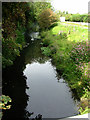
River Lark north of Tollgate Bridge
The view in the opposite direction to Image
Image: © John Goldsmith
Taken: 21 Aug 2011
0.04 miles
3

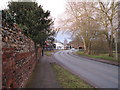
The River Lark
View from the bridge on Fornham Road, looking upstream towards Bury St Edmunds.
The River Lark is a chalk river and a tributary of the River Great Ouse. The river rises at Bradfield Combust, to the south of Bury St Edmunds, then flows through Bury, Mildenhall and Prickwillow before joining the Great Ouse south of Littleport in Cambridgeshire. It is about 31 miles (50 km) long, of which 10.1 miles (16.3 km) is navigable.
Image: © Richard Rogerson
Taken: 21 Jul 2026
0.06 miles
5
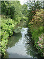
River Lark passes under Tollgate bridge
To the south west of this bridge the road is Fornham Road. To the north east it becomes Thetford Road. The river probably demarcates the border into the parish of Fornham. A public house one field nearer Bury is also called the Tollgate so clearly there used to be a gate on the main road around here. There is no trace of old stonework though.
Image: © John Goldsmith
Taken: 21 Aug 2011
0.06 miles
7
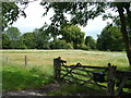
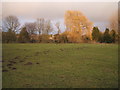
A field with a letter box
It is marked Priory Farm, but there is no sign of any human habitation - this is the field also seen in Image On the other side of the road is the Priory Hotel.
Actually the letterbox has appeared since the Google Street View camera passed by. The gate was intact at that time too.
Image: © John Goldsmith
Taken: 21 Aug 2011
0.08 miles
8
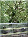
Drain parallel to River Lark
Under all that vegetation there is a so-called drain, running parallel to the river Lark. Actually there was no water in it at the time of the photograph.
Image: © John Goldsmith
Taken: 21 Aug 2011
0.08 miles
10
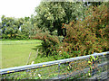
Drain on north of Thetford Road
Hiding under all that vegetation is a (dry) drain, or rivulet. The view in the other direction is shown in Image
Image: © John Goldsmith
Taken: 21 Aug 2011
0.10 miles