IMAGES TAKEN NEAR TO
Downside Close, IPSWICH, IP2 9YG
Introduction
This page details the photographs taken nearby to Downside Close, IP2 9YG by members of the Geograph project.
The Geograph project started in 2005 with the aim of publishing, organising and preserving representative images for every square kilometre of Great Britain, Ireland and the Isle of Man.

There are currently over 7.5m images from over14,400 individuals and you can help contribute to the project by visiting https://www.geograph.org.uk
Image Map
Images are licensed for reuse under creativecommons.org/licenses/by-sa/2.0
Notes
- Clicking on the map will re-center to the selected point.
- The higher the marker number, the further away the image location is from the centre of the postcode.
Image Listing (91 Images Found)
Images are licensed for reuse under creativecommons.org/licenses/by-sa/2.0
Image
Details
Distance
2
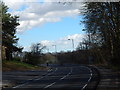
Trees at Stoke Park Drive
Opposite http://www.geograph.org.uk/photo/3859180.
Image: © Hamish Griffin
Taken: 21 Feb 2014
0.04 miles
3
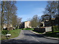
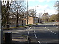
Stoke Park Drive at Ashground Plantation
Downside Close is the road on the left.
Image: © Hamish Griffin
Taken: 21 Feb 2014
0.05 miles
4
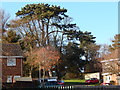
Trees opposite Ashground Plantation
Trees opposite Ashground Plantation on Stoke Park Drive near the Alderlee turn-off.
Image: © Hamish Griffin
Taken: 21 Feb 2014
0.05 miles
5
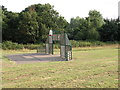
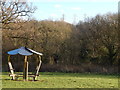
Stoke Park Drive open space
Whatever game this goal belongs to, there is only one of it
Image: © Keith Edkins
Taken: 4 Aug 2018
0.07 miles
6
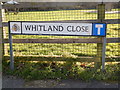
Whitland Close dead end sign
Whitland Close dead end sign. Whitland Close starts/ends at Stoke Park Drive.
Image: © Hamish Griffin
Taken: 21 Feb 2014
0.07 miles
7
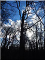
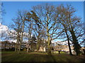
Trees at Ashground Plantation
Trees at Ashground Plantation, Stoke Park.
Image: © Hamish Griffin
Taken: 21 Feb 2014
0.08 miles
8
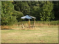
Stoke Park Drive open space
Don't know what this is - some sort of climbing frame?
Image: © Keith Edkins
Taken: 4 Aug 2018
0.08 miles
9
Alderlee, Stoke Park
Alderlee, a side road of Stoke Park Drive, Stoke Park at Ashground Plantation.
Image: © Hamish Griffin
Taken: 21 Feb 2014
0.08 miles
10
Shelter near Ashground Plantation
Closeup of http://www.geograph.org.uk/photo/3859180.
Image: © Hamish Griffin
Taken: 21 Feb 2014
0.08 miles