IMAGES TAKEN NEAR TO
Orchard Way, BURY ST. EDMUNDS, IP29 5SF
Introduction
This page details the photographs taken nearby to Orchard Way, IP29 5SF by members of the Geograph project.
The Geograph project started in 2005 with the aim of publishing, organising and preserving representative images for every square kilometre of Great Britain, Ireland and the Isle of Man.

There are currently over 7.5m images from over14,400 individuals and you can help contribute to the project by visiting https://www.geograph.org.uk
Image Map
Images are licensed for reuse under creativecommons.org/licenses/by-sa/2.0
Notes
- Clicking on the map will re-center to the selected point.
- The higher the marker number, the further away the image location is from the centre of the postcode.
Image Listing (145 Images Found)
Images are licensed for reuse under creativecommons.org/licenses/by-sa/2.0
Image
Details
Distance
1
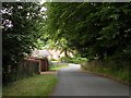
Part of Manor Lane
The buildings are part of Horringer Manor.
Image: © Robert Edwards
Taken: 13 Jul 2009
0.07 miles
2
![Horringer houses [16]](https://s0.geograph.org.uk/geophotos/06/76/14/6761496_ca03fc37_120x120.jpg)
Horringer houses [16]
The Gables in Manor Lane is an estate cottage built circa 1840. Built on a 'Y' plan in brick and faced with roughcast. Listed, grade II, with details at: https://historicengland.org.uk/listing/the-list/list-entry/1186986
The small village of Horringer, earlier known as Horningsheath lies astride the A143 road some two miles south west of Bury St Edmunds. The village includes the main entrance to Ickworth Park. There was once three blacksmiths’ forges in the village.
Image: © Michael Dibb
Taken: 15 Sep 2020
0.08 miles
4
![Horringer houses [15]](https://s2.geograph.org.uk/geophotos/06/76/14/6761494_abfedba6_120x120.jpg)
Horringer houses [15]
Once known as The Green, this pair of cottages, now combined into one, is named Charlotte Cottage, The Street. Built in the 18th century, timber framed and plastered with a thatched roof. There were alterations circa 1840 when the red brick chimney with a square base and 4 square flues, each having sunk panels, was added. There are 20th century extensions on both ends. Listed, grade II, with details at: https://historicengland.org.uk/listing/the-list/list-entry/1186991
The small village of Horringer, earlier known as Horningsheath lies astride the A143 road some two miles south west of Bury St Edmunds. The village includes the main entrance to Ickworth Park. There was once three blacksmiths’ forges in the village.
Image: © Michael Dibb
Taken: 15 Sep 2020
0.12 miles
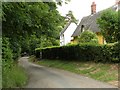
5
![Horringer features [3]](https://s3.geograph.org.uk/geophotos/06/76/14/6761495_9040da34_120x120.jpg)
Horringer features [3]
This fine tree is on the junction of The Street with Manor Lane.
The small village of Horringer, earlier known as Horningsheath lies astride the A143 road some two miles south west of Bury St Edmunds. The village includes the main entrance to Ickworth Park. There was once three blacksmiths’ forges in the village.
Image: © Michael Dibb
Taken: 15 Sep 2020
0.13 miles
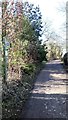
6
![Horringer houses [17]](https://s2.geograph.org.uk/geophotos/06/76/14/6761498_b1efc8a6_120x120.jpg)
Horringer houses [17]
Behind the tall hedge is this glimpse of The Forge in The Street. Built in the early 19th century in gault brick. At the rear is the forge, a one-storey building in gault brick. Listed, grade II, with details at: https://historicengland.org.uk/listing/the-list/list-entry/1205259
The small village of Horringer, earlier known as Horningsheath lies astride the A143 road some two miles south west of Bury St Edmunds. The village includes the main entrance to Ickworth Park. There was once three blacksmiths’ forges in the village.
Image: © Michael Dibb
Taken: 15 Sep 2020
0.14 miles
8
![Horringer houses [13]](https://s2.geograph.org.uk/geophotos/06/76/11/6761126_590e06e0_120x120.jpg)
Horringer houses [13]
Now three cottages, this was originally The Gildhall, dedicated to St John the Baptist and Holy Trinity, which used its income to give support to villagers in need. Built in the 16th century, timber framed and plastered with a thatched roof. The Gildhall became the village workhouse in the 17th century and circa 1836 it was extended and converted into cottages. The building was restored circa 1970. For a time the north end of the building was an infants' school. Listed, grade II, with details at: https://historicengland.org.uk/listing/the-list/list-entry/1186990
The small village of Horringer, earlier known as Horningsheath lies astride the A143 road some two miles south west of Bury St Edmunds. The village includes the main entrance to Ickworth Park. There was once three blacksmiths’ forges in the village.
Image: © Michael Dibb
Taken: 15 Sep 2020
0.14 miles
9
![Horringer houses [14]](https://s1.geograph.org.uk/geophotos/06/76/14/6761493_0d8f025a_120x120.jpg)
Horringer houses [14]
Alongside The Gildhall Image is this cottage. Built circa 1800, gable end to the street, timber framed and plastered with a thatched roof. When The Gildhall was the village workhouse, this cottage was the home of the governor. Listed, grade II, with details at: https://historicengland.org.uk/listing/the-list/list-entry/1298946
The small village of Horringer, earlier known as Horningsheath lies astride the A143 road some two miles south west of Bury St Edmunds. The village includes the main entrance to Ickworth Park. There was once three blacksmiths’ forges in the village.
Image: © Michael Dibb
Taken: 15 Sep 2020
0.15 miles
10
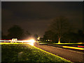
Horringer Green by night
The junction of the main road through the village - the A143 - and the drive to Ickworth Park, Ickworth House and Ickworth Hotel. A car coming from the house has illuminated the grass and tree across the road.
Image: © John Goldsmith
Taken: 11 Dec 2011
0.15 miles