Horringer houses [17]
Introduction
The photograph on this page of Horringer houses [17] by Michael Dibb as part of the Geograph project.
The Geograph project started in 2005 with the aim of publishing, organising and preserving representative images for every square kilometre of Great Britain, Ireland and the Isle of Man.

There are currently over 7.5m images from over 14,400 individuals and you can help contribute to the project by visiting https://www.geograph.org.uk
Horringer houses [17]
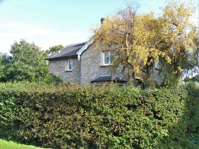
Image: © Michael Dibb Taken: 15 Sep 2020
Behind the tall hedge is this glimpse of The Forge in The Street. Built in the early 19th century in gault brick. At the rear is the forge, a one-storey building in gault brick. Listed, grade II, with details at: https://historicengland.org.uk/listing/the-list/list-entry/1205259 The small village of Horringer, earlier known as Horningsheath lies astride the A143 road some two miles south west of Bury St Edmunds. The village includes the main entrance to Ickworth Park. There was once three blacksmiths’ forges in the village.
Images are licensed for reuse under creativecommons.org/licenses/by-sa/2.0
Image Location
Latitude
52.226162
Longitude
0.673549