
IMAGES TAKEN NEAR TO
Smithy Close, BURY ST. EDMUNDS, IP29 4RH
Introduction
This page details the photographs taken nearby to Smithy Close, IP29 4RH by members of the Geograph project.
The Geograph project started in 2005 with the aim of publishing, organising and preserving representative images for every square kilometre of Great Britain, Ireland and the Isle of Man.

There are currently over 7.5m images from over14,400 individuals and you can help contribute to the project by visiting https://www.geograph.org.uk
Image Map
Images are licensed for reuse under creativecommons.org/licenses/by-sa/2.0
Notes
- Clicking on the map will re-center to the selected point.
- The higher the marker number, the further away the image location is from the centre of the postcode.
Image Listing (21 Images Found)
Images are licensed for reuse under creativecommons.org/licenses/by-sa/2.0
Image
Details
Distance
1

Chapel Road
Looking west towards Hoggard's Green.
Image: © JThomas
Taken: 20 May 2017
0.11 miles
2

Crop field near Methodist Chapel, Bradfield Combust
North of Chapel Road.
Image: © JThomas
Taken: 20 May 2017
0.13 miles
3
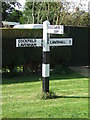
Finger Post
Finger post at Stanningfield, Suffolk.
Image: © Keith Evans
Taken: 25 Sep 2011
0.14 miles
5
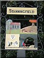
Stanningfield village sign
Stanningfield village sign Stanningfield Suffolk. For overall view of the sign see http://www.geograph.org.uk/photo/832191
Image: © Keith Evans
Taken: 5 Jun 2008
0.15 miles
6
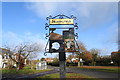
Stanningfield village sign
https://www.geograph.org.uk/photo/6323501
Image: © Adrian S Pye
Taken: 18 Nov 2019
0.16 miles
7
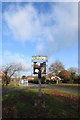
Stanningfield village sign
https://www.geograph.org.uk/photo/6323503
Image: © Adrian S Pye
Taken: 18 Nov 2019
0.16 miles
8
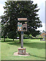
Stanningfield village sign
The sign depicts the church of St Nicholas and the agricultural heritage is represented by the horse and plough. In the lower section a reference to the Gunpowder Plot in November 1605, when local Catholic, Ambrose Rokewood was enlisted by Robert Catesby, a religious zealot and was one of the those who was subsequently hanged, drawn and quartered for his part in the conspiracy. The Coats of Arms are those used by the Rokewood family.
http://www.geograph.org.uk/photo/4294741
Image: © Adrian S Pye
Taken: 18 Jul 2007
0.16 miles
9
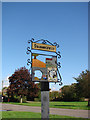
Stanningfield village sign (detail)
The sign depicts the church of St Nicholas and the agricultural heritage is represented by the horse and plough. In the lower section a reference to the Gunpowder Plot in November 1605, when local Catholic, Ambrose Rokewood was enlisted by Robert Catesby, a religious zealot and was one of the those who was subsequently hanged, drawn and quartered for his part in the conspiracy. The Coats of Arms are those used by the Rokewood family. https://www.geograph.org.uk/photo/4294740
Image: © Adrian S Pye
Taken: 8 Oct 2008
0.16 miles
10
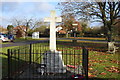
Stanningfield War Memorial on Hoggard's Green.
The memorial which replaced a wooden cross bears the names of twelve men lost in the Great War and of four lost in the Second World War.
View the names here https://www.geograph.org.uk/photo/6323492
Image: © Adrian S Pye
Taken: 18 Nov 2019
0.16 miles