
IMAGES TAKEN NEAR TO
Wherstead Road, IPSWICH, IP2 8LN
Introduction
This page details the photographs taken nearby to Wherstead Road, IP2 8LN by members of the Geograph project.
The Geograph project started in 2005 with the aim of publishing, organising and preserving representative images for every square kilometre of Great Britain, Ireland and the Isle of Man.

There are currently over 7.5m images from over14,400 individuals and you can help contribute to the project by visiting https://www.geograph.org.uk
Image Map
Images are licensed for reuse under creativecommons.org/licenses/by-sa/2.0
Notes
- Clicking on the map will re-center to the selected point.
- The higher the marker number, the further away the image location is from the centre of the postcode.
Image Listing (72 Images Found)
Images are licensed for reuse under creativecommons.org/licenses/by-sa/2.0
Image
Details
Distance
4
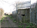
WW2 hexagonal pillbox below the embankment
The pillbox is adjacent to the Ipswich to London railway line. It is situated at the foot of the embankment. Unusually it has a 360 degree firing range. It has an embrasure above the low doorway with a low blast wall protecting the occupant's legs and torso whilst firing. It is currently serving the community as a rubbish collection point. The railing are there to stop people using it to access the railway track.
http://www.geograph.org.uk/photo/4378655
Image: © Adrian S Pye
Taken: 10 Mar 2015
0.07 miles
5
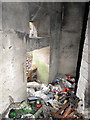
Inside the pillbox with 360 degree firing capability
http://www.geograph.org.uk/photo/4378646 Showing the embrasure above the doorway
Image: © Adrian S Pye
Taken: 10 Mar 2015
0.07 miles
6
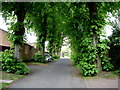
No-through road to Maidenhall
Wherstead Road is pretty grim, but this (unnamed as far as I could see) little cut-through (closed to motorised traffic, but passable by cycles and pedestrians) provides a quiet and green passage through to Maidenhall.
Image: © Oxymoron
Taken: 9 May 2009
0.08 miles
7
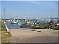
River Orwell slipway
The slipway for the Orwell Yacht Club, on the western side of the river, near Bourne Bridge.
Image: © Bob Jones
Taken: Unknown
0.09 miles
8
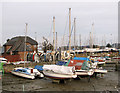
The tide is out, Belstead Creek
Boats in the mud by Old Bourne Bridge, waiting to be set afloat again once the tide has come in.
Image: © Evelyn Simak
Taken: 29 Jan 2012
0.11 miles
9
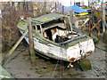
Dilapidated old boat in Belstead Brook, Ipswich
Image: © Evelyn Simak
Taken: 29 Jan 2012
0.11 miles
10
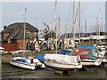
Boats moored in Belstead Creek, Ipswich
Image: © Evelyn Simak
Taken: 29 Jan 2012
0.11 miles