WW2 hexagonal pillbox below the embankment
Introduction
The photograph on this page of WW2 hexagonal pillbox below the embankment by Adrian S Pye as part of the Geograph project.
The Geograph project started in 2005 with the aim of publishing, organising and preserving representative images for every square kilometre of Great Britain, Ireland and the Isle of Man.

There are currently over 7.5m images from over 14,400 individuals and you can help contribute to the project by visiting https://www.geograph.org.uk
WW2 hexagonal pillbox below the embankment
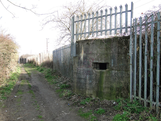
Image: © Adrian S Pye Taken: 10 Mar 2015
The pillbox is adjacent to the Ipswich to London railway line. It is situated at the foot of the embankment. Unusually it has a 360 degree firing range. It has an embrasure above the low doorway with a low blast wall protecting the occupant's legs and torso whilst firing. It is currently serving the community as a rubbish collection point. The railing are there to stop people using it to access the railway track. http://www.geograph.org.uk/photo/4378655
Images are licensed for reuse under creativecommons.org/licenses/by-sa/2.0
Image Location
Latitude
52.037135
Longitude
1.148833