IMAGES TAKEN NEAR TO
Freckenham Road, BURY ST. EDMUNDS, IP28 8SQ

Introduction

This page details the photographs taken nearby to Freckenham Road, IP28 8SQ by members of the Geograph project.

The Geograph project started in 2005 with the aim of publishing, organising and preserving representative images for every square kilometre of Great Britain, Ireland and the Isle of Man.

There are currently over 7.5m images from over14,400 individuals and you can help contribute to the project by visiting https://www.geograph.org.uk

Image Map


Images are licensed for reuse under creativecommons.org/licenses/by-sa/2.0
Notes
  • Clicking on the map will re-center to the selected point.
  • The higher the marker number, the further away the image location is from the centre of the postcode.

Image Listing (31 Images Found)

Images are licensed for reuse under creativecommons.org/licenses/by-sa/2.0
  • ...
Image
Details
Distance
1
The Meadows, Worlington
The road is divided down the middle in two grid squares
Image: © David Howard Taken: 19 Sep 2021
0.02 miles
2
Road junction in Worlington
This is the western end of the village where Isleham Road branches off Freckenham Road.
Image: © Bill Boaden Taken: 26 Apr 2015
0.04 miles
3
Back Of Give Way Sign
Back of a give way sign at the junction of a minor road onto the Freckenham Road near to Worlington, Suffolk.
Image: © Keith Evans Taken: 13 Sep 2012
0.07 miles
4
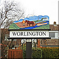
Worlington Village sign
With some post-war housing on Walnut Grove behind.
Image: © Hugh Venables Taken: 9 May 2010
0.08 miles
5
Worlington village sign
The Worlington sign depicts a horse towing a barge containing malted barley to the brewery at Ely along the River Lark. The River Lark was navigable almost as far as Bury St Edmunds thirteen miles to the southeast. In the opposite direction it was the route by which good Suffolk barley was transported to the brewery at Ely, thirteen miles to the northwest.  The sign has been renovated and can be seen here https://www.geograph.org.uk/photo/6788023  
Image: © Adrian S Pye Taken: 12 Oct 2008
0.08 miles
6
Worlington village sign
The Worlington sign depicts a horse towing a barge containing malted barley to the brewery at Ely along the River Lark. The River Lark was navigable almost as far as Bury St Edmunds thirteen miles to the southeast. In the opposite direction it was the route by which good Suffolk barley was transported to the brewery at Ely, thirteen miles to the northwest. 
Image: © Adrian S Pye Taken: 2 Mar 2021
0.08 miles
7
Worlington village sign
The Worlington sign depicts a horse towing a barge containing malted barley to the brewery at Ely along the River Lark. The River Lark was navigable almost as far as Bury St Edmunds thirteen miles to the southeast. In the opposite direction it was the route by which good Suffolk barley was transported to the brewery at Ely, thirteen miles to the northwest.  https://www.geograph.org.uk/photo/6788023
Image: © Adrian S Pye Taken: 2 Mar 2021
0.08 miles
8
War memorial, Worlington
On the junction between The Street and Church Lane. It's sad that these are such familiar sights, but right that everyone is remembered; I'm glad I'm living now and not then.
Image: © Hugh Venables Taken: 17 Jan 2010
0.08 miles
9
Worlington Village Sign
Village sign for Worlington, Suffolk.
Image: © Keith Evans Taken: 13 Sep 2012
0.08 miles
10
Freckenham Road, Worlington
I think the widespread NO posters were something to do with a solar farm or a rail link, those were the two issues across the area.
Image: © David Howard Taken: 19 Sep 2021
0.09 miles
  • ...