
IMAGES TAKEN NEAR TO
Church Lane, BURY ST. EDMUNDS, IP28 8PD
Introduction
This page details the photographs taken nearby to Church Lane, IP28 8PD by members of the Geograph project.
The Geograph project started in 2005 with the aim of publishing, organising and preserving representative images for every square kilometre of Great Britain, Ireland and the Isle of Man.

There are currently over 7.5m images from over14,400 individuals and you can help contribute to the project by visiting https://www.geograph.org.uk
Image Map
Images are licensed for reuse under creativecommons.org/licenses/by-sa/2.0
Notes
- Clicking on the map will re-center to the selected point.
- The higher the marker number, the further away the image location is from the centre of the postcode.
Image Listing (24 Images Found)
Images are licensed for reuse under creativecommons.org/licenses/by-sa/2.0
Image
Details
Distance
2
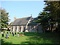
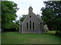
West Row St Peter?s church
Half-hidden by trees of various species this little church was built in 1850 as a school. It became a church in 1875 when West Row was declared a parish and no longer a hamlet of Mildenhall. New windows were put in, a porch and vestry were added, and the appearance of the whole building was changed. Inside the church, the chancel arch is cusped, which appears most strange. The roof is supported with plain queen-posts. The furnishings, pews, pulpit and stalls, indeed everything in the church is contemporary and purely functional. It is an honest building, and no attempt has been made to make it anything other than what it is. It sits in its own very neat and tidy graveyard, which is sparsely populated with headstones huddled together in one corner.
Image: © Adrian S Pye
Taken: 12 Oct 2008
0.02 miles
3
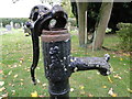
Churchyard pump (Detail)
http://www.geograph.org.uk/photo/5163266
Image: © Adrian S Pye
Taken: 21 Oct 2016
0.03 miles
4
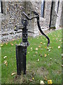
Churchyard pump of dubious practicality
For the use of those wishing to put flowers in water on the graves. This is not the Close Look that is here > http://www.geograph.org.uk/photo/5163267
Image: © Adrian S Pye
Taken: 21 Oct 2016
0.03 miles

6
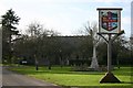
West Row village centre
Village sign on the green, with church behind.
Image: © Bob Jones
Taken: 4 Dec 2006
0.05 miles
7
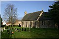
St Peter's Church, West Row
A Victorian church in a suburb of Mildenhall, dominated by the American presence of the nearby airbase.
Image: © Bob Jones
Taken: 4 Dec 2006
0.05 miles
8
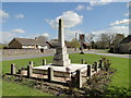
West Row War Memorial and village sign
The Memorial stands directly opposite the church on a small triangular green with the village sign in the background.
The memorial bears 35 names from WW1 and eight from WW2.
Image: © Adrian S Pye
Taken: 19 Apr 2016
0.06 miles
9

NEW
WW1 names on the West Row war memorial (1)
Image: © Helen Steed
Taken: 9 Sep 2026
0.06 miles
10

NEW
WW1 names on the West Row war memorial (2)
Image: © Helen Steed
Taken: 9 Sep 2026
0.06 miles